Shared posts

31 Aug 17:59

8BitDo is making a customizable arcade stick for Switch and PC players

by Nick Summers

It’s time to fight with style. 8BitDo has unveiled a new arcade stick that looks like the lovechild of a Nintendo Entertainment System (NES) and Street Fighter V cabinet. The peripheral, which supports PC and Switch, has a bunch of customisation options to suit different players. It has a “universal mounting plate,” for instance, so fighting game enthusiasts can swap in sticks and buttons made by other manufacturers. It also supports 8BitDo’s Ultimate Software so that, unlike the company’s old N30 arcade stick, you can change the button mapping, save custom profiles, and execute macros with the P1 and P2 options in the top right-hand corner.

The flexibility doesn’t stop there, though. You can connect the stick over Bluetooth, a USB-C cable, or a wireless 2.4G receiver that’s cleverly stored on the underside of the stick. It also has a rechargeable 1000 mAh battery, so you can go anywhere — the park, a coffee shop, or an airport terminal with zero power outlets — and play some Mortal Kombat 11 with your Switch in tabletop mode. If you’re carrying a laptop too, you can flick a knob to instantly toggle between the stick’s Switch and PC-centric XInput modes. The red buttons will immediately remap and, impressively, their labels will change thanks to some LEDs built into the dark grey panel.

Alongside that physical switcher is a second knob that lets you use the stick as a D-pad, left or right analog stick. In theory, that means you could play a 3D platformer or first-person shooter with this thing. The stick also has dedicated Home and screenshot buttons — mimicking the functionality found on a pair of Joy-Cons — Start and Select shortcuts, and a slider for switching between Bluetooth and 2.4G. 8BitDo isn’t the only company making fighting sticks for the Switch, and there’s even more options if you only play on PC. Still, 8BitDo has a solid reputation for building high quality controllers inspired by classic systems such as the Sega Genesis.

8BitDo Arcade Stick
8BitDo

If you’re interested, the company’s new arcade stick is available to pre-order today for $89.99. The first units should ship on October 20th.

31 Aug 17:57

Straightening my hair

by Cassandra Calin

Perhaps.

31 Aug 14:47

Angel a Day

by Mary Kelly

Angel a Day Crafting

Crafting an Angel a Day
Scott, ed.
2000

If you are a fan of rather weird looking or cartoon-like angels, this book might be for you. There is a wide variety of angel themed crafts. I am not a fan of these types of decorations, but I know a lot of people like this stuff. What I did like about this book were the instructions. The skills required were not ridiculous like some of the books we have featured. Good craft books are really about instruction. This one is better than most. Depending on condition, this might work fine for your collection.

1 or two angels for the Christmas tree, perfectly fine at my house. Any more than that, especially given how these angels look, and I am going to have a problem. If I had to craft an angel a day, I would probably have to be medicated.

One more thing, if you notice the top of the front cover it has the publication house called House of White Birches. (Sorry, the photo sort of makes that difficult to see.) My husband and I read that as “House of White B!tches”. This is what happens when your eyesight starts to fade.

Not your angel,

Mary

back cover

angel bear

angel statue

angel switch plate

angel switch plate

angel sweatshirt

The post Angel a Day appeared first on Awful Library Books.

31 Aug 14:44

Hurricane Hunters

Our flight gathered valuable data on whether a commercial airliner in the eye of a hurricane can do a loop.
31 Aug 12:43

Some In GOP Fear Trump's Push Against Mail-In Voting Could Harm The Party's Chances

by Maayan Silver
A poll worker in Sun Prairie, Wis., is seen during the state

Trump's supporters don't trust voting by mail, said one local Wisconsin GOP chair. "And one of the reasons they don't trust it," he said, "is the president's previous tweets and comments about it."

(Image credit: Andy Manis/Getty Images)

31 Aug 12:33

So, this is pretty miserable. How much longer will summer last?

by Eric Berger

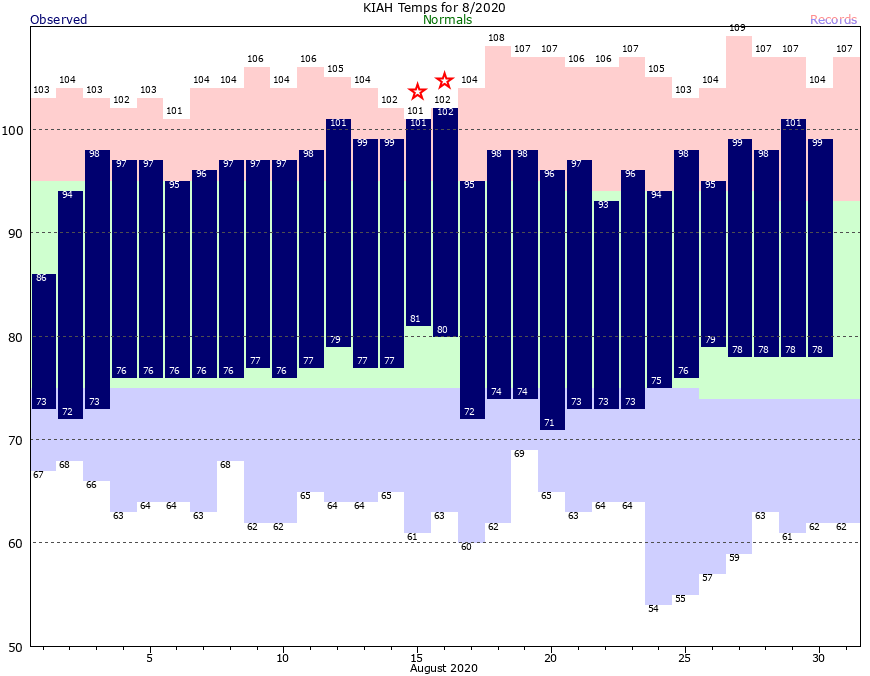
Lost amid the concern about Hurricane Laura over the last week is that summer pretty much has chugged along and late August in Houston is doing late August things. Saturday’s high temperature reached 101 degrees at Bush Intercontinental Airport, and the dew points of around 80 degrees on some recent mornings have just been gross. The question in everyone’s mind, therefore, is when will it end? The flippant answer for long-time Houston residents is November. But the real answer is that, just maybe, we’re about 10 days away from the region’s first real cool front.

August, as usual, has been quite hot and humid. (National Weather Service)

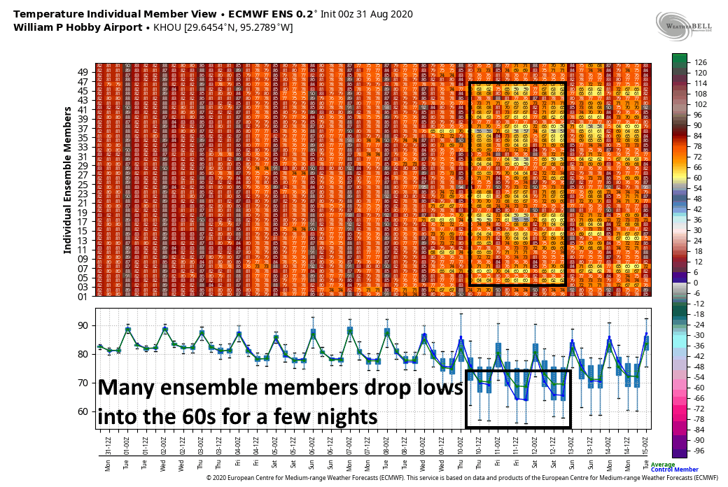
As we’ll discuss in the post below, our weather for the next week remains hot. But about 10 days from now there are hints in the global models of a decently strong cold front arriving in the Houston area. There are a couple of reasons for skepticism: We get a lot of “mirage” fronts popping up in the models at this time of year that falsely advertise the arrival of cool fronts, and this one would be about two weeks earlier than normal for Houston. On the other hand, this front has been fairly consistent in the model forecasts. At this point, therefore, I would say there is about a 50 percent chance of a nice front pushing into Houston about 10 days from now. That is not a guarantee.

European ensemble model for forecast lows through Monday, September 15. (Weather Bell)

Monday

Welcome to a new week, with plenty of more heat. Today will see partly to mostly sunny skies across the region. Some moisture has surged into the region, and this probably will be enough to generate some short-lived showers and thunderstorms for about 30 percent of the area. Southerly winds will be noticeable, gusting to about 20 mph. Unless showers cool you off this afternoon, expect high temperatures to get into the mid- to upper-90s. Overnight temperatures will remain very sticky.

Tuesday, Wednesday, and Thursday

For now we don’t anticipate a whole lot of variance across these three days with partly to mostly sunny skies and daily highs in the mid-90s. We can’t entirely rule out some showers on the northwest or northern periphery of the Houston metro area, but for the most part we’re going to see no rain. Nights will be sticky and warm.

Friday, Saturday, and Sunday

By this weekend some clouds enter the forecast and a front over north Texas may help to generate some showers over Houston. But for now the weekend forecast remains fairly uncertain—except for the fact that we can probably count on plenty of heat.

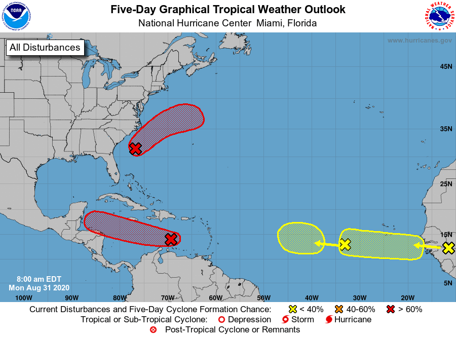
Five-day tropical outlook from the National Hurricane Center at 7am CT Monday.

Tropics

I wrote a quick post about the tropics on Sunday, and our general thinking remains the same. While there are lots of areas of interest across the Atlantic Basin today, we still don’t see too much to be concerned about when it comes to the U.S. Gulf Coast. Matt will have more in his weekly tropics post on Tuesday.

30 Aug 18:23

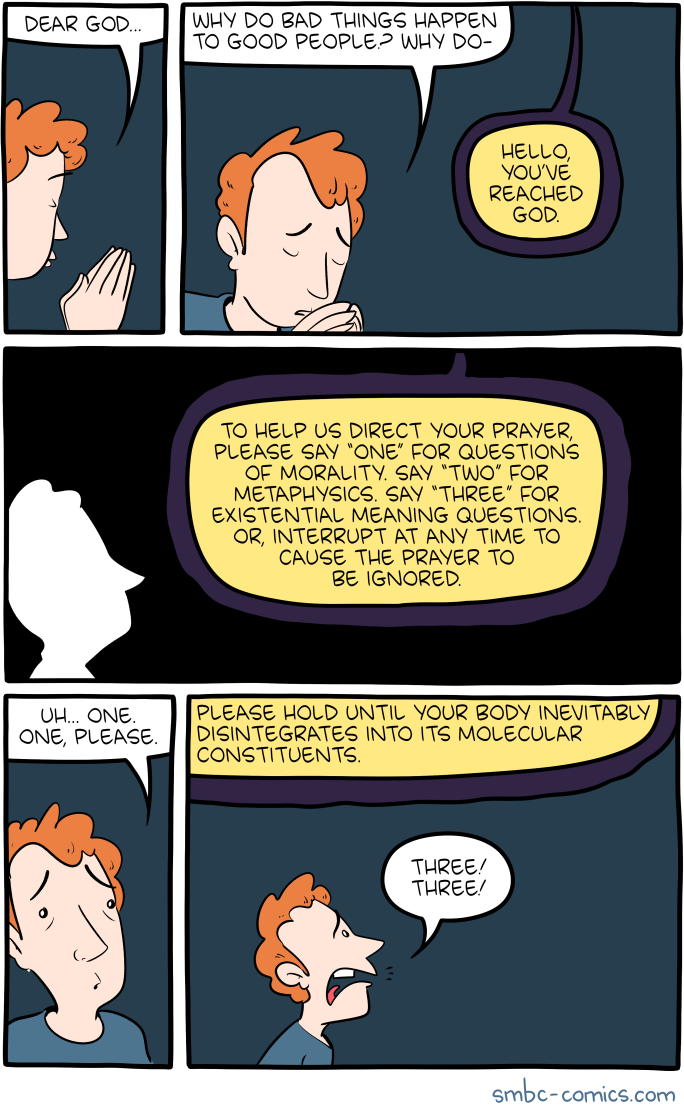
Saturday Morning Breakfast Cereal - Memory

by tech@thehiveworks.com


Click here to go see the bonus panel!

Hovertext:
Speak, Memory! And do it naked!


Today's News:
29 Aug 20:26

Comic for 2020.08.28

New Cyanide and Happiness Comic
29 Aug 20:25

Gun Ownership In America: A Flowchart

by Carlos Greaves

“Police have charged Kyle Rittenhouse, 17, with murder in connection with the shootings that killed that man and another protester after he drove to Kenosha with a rifle to stand with others in self-styled militias claiming to guard local businesses. But [Tucker Carlson] argued that the teen’s actions were understandable after days of chaos.” — Washington Post, 8/26/20

- - -

Click chart to enlarge

29 Aug 20:24

Saturday Morning Breakfast Cereal - The End of History

by tech@thehiveworks.com


Click here to go see the bonus panel!

Hovertext:
Suplexocracy is the only legitimately awesome form of government.


Today's News:
29 Aug 14:34

Synonym Date

We need some grub to munch--I'll go slouch over to the kitchen.
29 Aug 03:52

'Black Panther' Star Chadwick Boseman Dies Of Cancer At Age 43

by Malaka Gharib
In his role as superhero Black Panther, Chadwick Boseman became the face of the Marvel Cinematic Universe

A statement posted to the actor's Twitter on Friday said Boseman had battled colon cancer for the last four years.

(Image credit: Cheriss May/NurPhoto via Getty Images)

28 Aug 19:56

Saturday Morning Breakfast Cereal - Holding

by tech@thehiveworks.com


Click here to go see the bonus panel!

Hovertext:
You need to start with three, so you can stop worrying about 1 and 2.


Today's News:
28 Aug 19:55

How Space City Weather weathered Hurricane Laura

by Lee Hutchinson

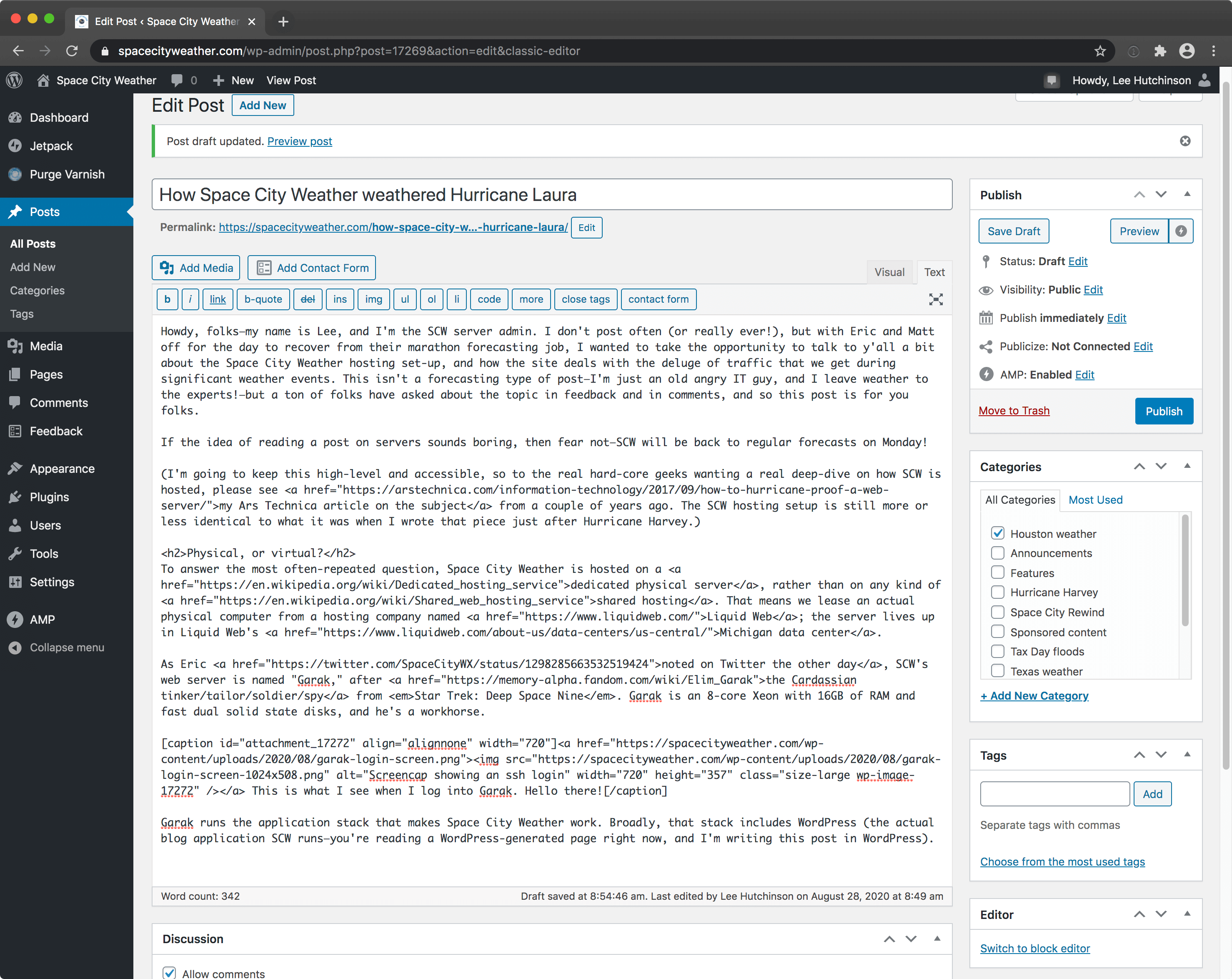
Howdy, folks—my name is Lee, and I’m the SCW server admin. I don’t post often (or really ever!), but with Eric and Matt off for the day to recover from their marathon forecasting job, I wanted to take the opportunity to talk to y’all a bit about how Space City Weather works, and how the site deals with the deluge of traffic that we get during significant weather events. This isn’t a forecasting type of post—I’m just an old angry IT guy, and I leave weather to the experts!—but a ton of folks have asked about the topic in feedback and in comments, so if you’re curious about what makes SCW tick, this post is for you.

On the other hand, if the idea of reading a post on servers sounds boring, then fear not—SCW will be back to regular forecasts on Monday!

(I’m going to keep this high-level and accessible, so if there are any hard-core geeks reading here who are jonesing for a deep-dive on how SCW is hosted, please see my Ars Technica article on the subject from a couple of years ago. The SCW hosting setup is still more or less identical to what it was when I wrote that piece just after Hurricane Harvey.)

How much traffic just blew through?

So, fun stuff first. On a normal day, Space City Weather does something like 10,000-20,000 page views to something like 5,000-10,000 visitors. This traffic is generated from folks who specifically visit spacecityweather.com, so those numbers don’t include people who just read the SCW e-mail or just peep at posts on the SCW Facebook page. (“Page views” are a good metric for how much work your server has to do, with each “page view” representing one page of content that the SCW server has to send to you—a page like this article that you’re reading right now, for example. “Visitors,” on the other hand, is the absolute number of people who stopped by. Some visitors look at more than one article, so you’re typically going to have more page views than visitors.)

Our peak traffic day with Hurricane Laura was Tuesday, August 25, when things looked like they might go very badly for Houston. On that day, we clocked a smidge under 1.6 million views to about 520,000 visitors:

Screenshot of the WordPress stats page showing huge traffic

This is a screenshot of the WordPress stats for the duration of Hurricane Laura.

That’s about 160x our usual daily traffic load, and even higher than the 1.1 million views we hit during the peak of Hurricane Harvey two years ago. And, unlike Harvey’s traffic, we ended up with not one but a pair of million-view days—August 25’s 1.6 million views were followed with another 1.3 million on August 26.

To put that load in terms of pages-per-second, SCW was serving up between 20-50 pages every second for hours at a time on both Tuesday and Wednesday. And the site did it without breaking a sweat.

How? Well, there’s the trick—we cheat a bit.

The stack

But first, before I explain how we cheat, I’ll talk just for a moment about the hardware and software that powers the site. Space City Weather is hosted on a dedicated physical server, rather than on any kind of shared hosting. That means we lease an actual physical computer from a hosting company named Liquid Web; the server lives up in Liquid Web’s Michigan datacenter. There’s a very good reason we don’t host the server in a Houston datacenter, even though there are many fine options—having your servers in the same place as the disaster you’re reporting on is not a strategy conducive to uptime, as we say in the biz.

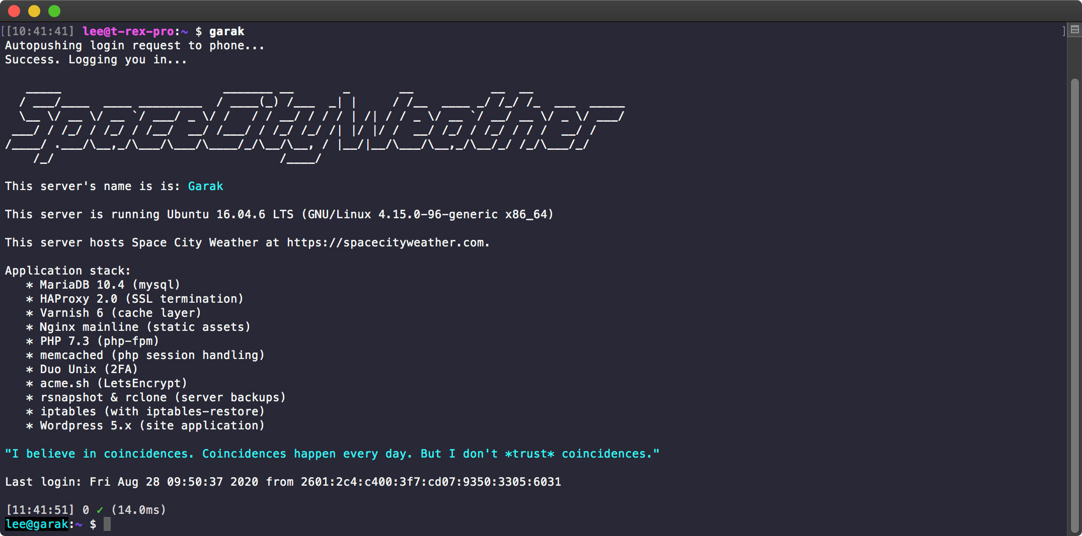
As Eric noted on Twitter the other day, SCW’s web server is named “Garak,” after the Cardassian tinker/tailor/soldier/spy from Star Trek: Deep Space Nine. Garak is an 8-core Xeon with 16GB of RAM and fast dual solid state disks, and he’s a workhorse.
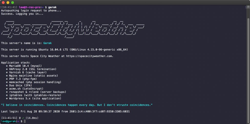
Screenshot of a login banner for a linux server

This is what I see when I log into Garak. Hello there!

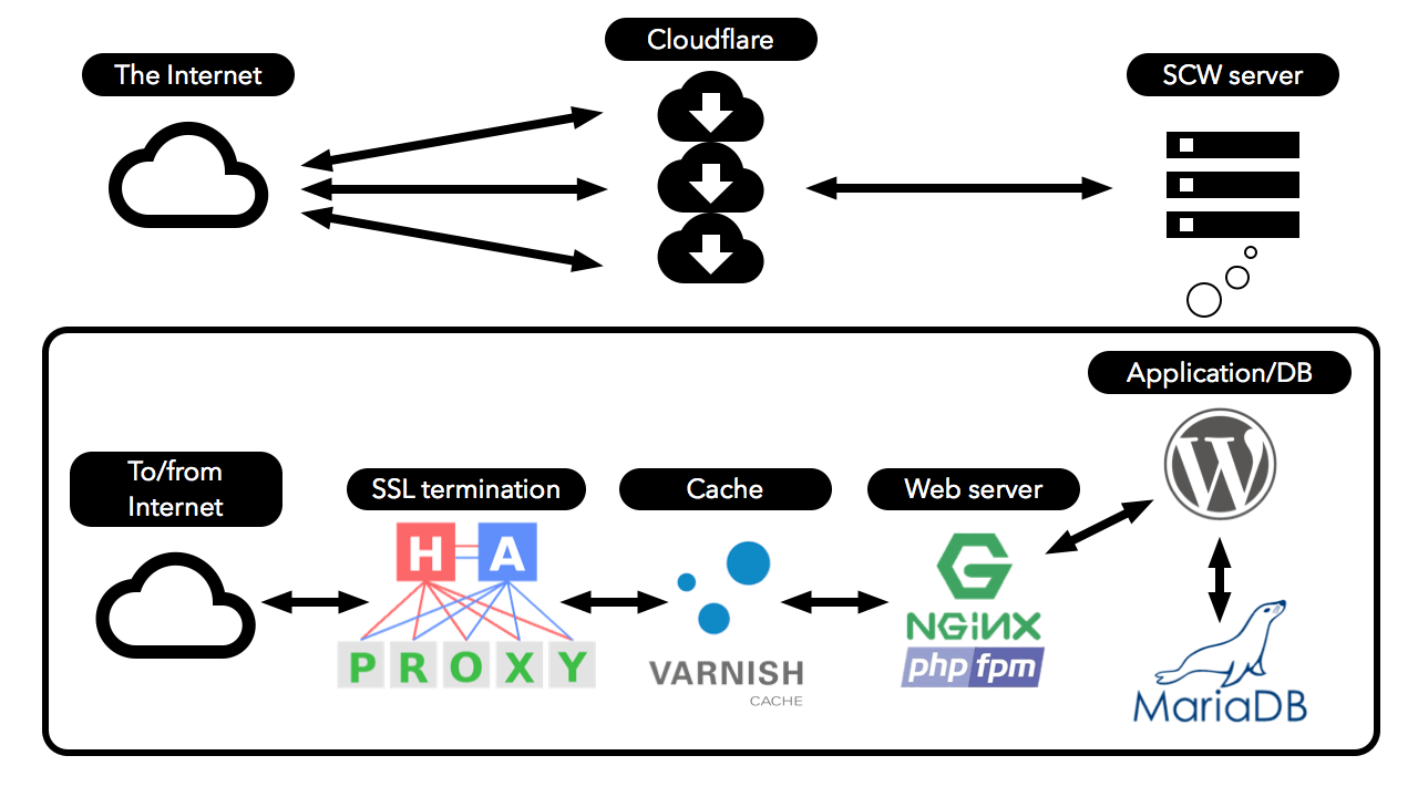
Garak runs the application stack that makes Space City Weather work. That stack includes WordPress, the actual blog application SCW runs—you’re reading a WordPress-generated page right now, and I’m writing this post in WordPress. Garak also runs Nginx (pronounced “engine-ex”), the actual web server application that sends you pages and pictures. There’s also a database to hold WordPress posts and configuration data, a heavy duty caching layer (using Varnish), and an SSL termination layer (using HAProxy) for keeping things secure while still taking advantage of cache.
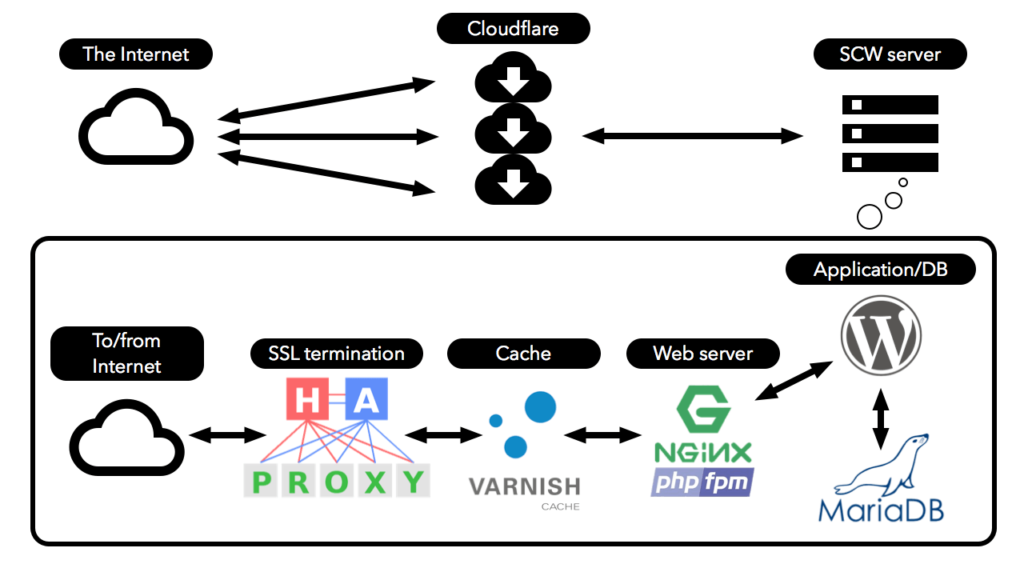
Block diagram

This is a block diagram of the Space City Weather web stack, showing how all the pieces fit together.

Why do we use physical hosting (which is admittedly more expensive) rather than cloud-based hosting at AWS or another cloud provider? The answer is simple: because physical hosting is easy. I don’t have to know or care how to have multiple cloud servers of varying capacities standing by to come online in the event of a traffic storm—we just always have the big gun (that is, the physical server) in place. Liquid Web’s rates are reasonable and it’s a cost-effective solution that trades time for money, and I’m always going to spend money to gain time if that’s an option.

The cheat

But here’s the thing—like I said, we kind of cheat at big traffic events a bit, and the way we cheat is by using Cloudflare.

In the simplest terms, Cloudflare is a service that absorbs your network load for you. Space City Weather is the kind of site that lends itself very well to caching—that is, most of Space City Weather’s pages don’t change very often, so you can take advantage of that and distribute copies of those un-changing pages out to Cloudflare’s army of servers. When the traffic storm arrives, Cloudflare’s monster servers send the unchanging parts of the site to visitors, and Garak only has to be bothered when something does change—when Eric or Matt create or update a post, for example.

Spreading the load out to a paid service like Cloudflare is shockingly effective. How effective? This chart from Space City Weather’s Cloudflare dashboard tells the tale in a single picture:

Screenshot of the bandwidth graph from a Cloudflare dashboard

Dark blue represents traffic serviced by Cloudflare, and light blue represents traffic that Garak had to serve. Notice how there’s basically no light blue.

Over the last week, Space City Weather served a bit under 12 terabytes of data to visitors. That is a stupidly ridiculously large amount of traffic. But out of that monster chunk of data, Garak only had to serve up about 110 gigabytes. A terabyte is 1000 gigabytes (or 1024 gigabytes, depending on what you’re measuring and who you’re talking to, but I’m trying to keep things simple), so Cloudflare handled about 99% of the Hurricane Laura traffic. This left Garak with only about 1% of the total work.

Considering that Garak’s monthly bandwidth allocation from Liquid Web is only 5 terabytes and every gigabyte over that comes with a penalty fee, we’d be looking at expensive overage charges without Cloudflare in place to handle the load. (And that’s not even addressing the fact that we’d probably need to spread things out between more than one physical server!)

Cloudflare more or less makes Space City Weather possible.

Funding, and the future

Fortunately, Cloudflare is also very kind to us on pricing. Because our monster traffic events are so rare and so peak-y (as opposed to constant and sustained), we get by on Cloudflare’s lowest-cost paid plan. That, along with all of our hosting and infrastructure costs, are handled via Reliant’s ongoing yearly sponsorship of Space City Weather. This enables us to keep the site very lean and focused on speed above all else, without intrusive ads, autoplaying garbage video, pop-ups, or any of that other annoying crap other sites have to festoon themselves with to earn money.

We’re nothing without our audience, and SCW readers are the best. As a life-long Houstonian born and raised, it brings me a lot of pride to see SCW thriving; this site is definitely a home-grown labor of love. And we hear your requests to help out, too—for new readers who perhaps just found SCW because of Hurricane Laura, we do have a fundraiser where folks can purchase SCW t-shirts, umbrellas, and a few other items. If you’re looking to score some sweet SCW merch, fundraiser time is the time to do it—that will be in November.

Thanks for taking the time to read this technical update, if you’ve made it this far, and thanks for stopping by the site. Eric and Matt will be back to forecasting on Monday, and we hope you’ll stick around!


28 Aug 16:29

What Trump Didn’t Say In His RNC Speech Is As Important As What He Did Say

by Galen Druke, Nate Silver, Clare Malone and Micah Cohen

The FiveThirtyEight Politics podcast crew reacts to the fourth and final night of the 2020 Republican National Convention.

28 Aug 14:46

'Radical' Coronavirus Testing Plan Could Offer A 'Return To Normal,' Journalist Says

by Terry Gross
An urgent care worker wears personal protective equipment in drive-up testing for the coronavirus in the Los Angeles area. Leading public health scientists tell journalist Alexis Madrigal that widespread at-home testing could help contain the virus.

Atlantic journalist Alexis Madrigal says millions of at-home saliva tests for the coronavirus could be the key to a safe reopening — even if they are less accurate than the traditional PCR tests.

(Image credit: Kevin Winter/Getty Images)

28 Aug 14:39

Water, Water, Every Where — And Now Scientists Know Where It Came From

by Nell Greenfieldboyce
The Pacific Ocean from space. In both liquid and frozen form, water covers most of the Earth

Some unusual meteorites suggest that Earth got its water at its start, rather than forming dry and being watered by comets later on.

(Image credit: Stocktrek Images/Getty Images)

28 Aug 14:37

Hurricane Laura Rips Down 'South's Defenders' Confederate Statue In Lake Charles

by Bill Chappell
The controversial South

Protesters had asked the parish to remove the prominent memorial this summer, only to be turned away two weeks ago. Then came the hurricane.

(Image credit: Courtesy of Renee C. )

28 Aug 14:35

Historic Gulf Coast Hurricanes: How Does Laura Compare?

by Scott Neuman
Parnell McKay, the civil defense director of Pass Christian, Miss., looks over the town

Hurricane Laura has been described as one of the most powerful storms to hit the Gulf Coast in decades. We take a look at other infamous storms to strike the region.

(Image credit: Jack Thornell/AP)

28 Aug 14:30

Kenosha Shooting Suspect Charged With Six Criminal Counts, Including Homicide

by Rachel Treisman
Demonstrators revisit the site where a protester was killed in Kenosha, Wis. On Aug. 25, 17-year-old Kyle Rittenhouse shot and killed two protesters. He was charged on Thursday with six criminal counts, including first-degree intentional homicide.

Illinois teenager Kyle Rittenhouse is facing five felony charges and one misdemeanor charge in connection with a shooting in Kenosha, Wis., that left two protesters dead and another injured.

(Image credit: Brandon Bell/Getty Images)

28 Aug 14:30

7 Takeaways From The Republican National Convention

by Domenico Montanaro
From left, Kimberly Guilfoyle, Donald Trump Jr., Tiffany Trump, President Donald Trump, first lady Melania Trump and Barron Trump stand on the South Lawn of the White House on the fourth day of the Republican National Convention.

It's going to be a nasty post-Labor Day sprint to Election Day, as both parties argue that the soul of America is at stake. For Republicans, it's all about trying to stick the culture war to Biden.

(Image credit: Evan Vucci/AP)

28 Aug 14:23

Hurricane Laura's Impact: 'The Wind Just Tore Everything Up'

by Bill Chappell
Damaged buildings and homes are damaged in the aftermath of Hurricane Laura near Lake Charles, La., Thursday.

"It tore the brick off, it tore the roof off, it lifted the truck by its roof. I mean, it tore everything. I have a skylight in my truck right now," a fire department volunteer said.

(Image credit: David J. Phillip/AP)

28 Aug 14:20

my employee keeps getting deadnamed by a coworker

by Ask a Manager

A reader writes:

I have managed “John,” a transgender man, for about two years. John does not keep his transgender status a secret, but he also doesn’t go out of his way to tell people, so some people know and some don’t. “Lizzy” recently transferred to a department that works closely with ours. She previously did not know that John was trans, but now that she’s interacting with him much more often, she’s found out. At first, she didn’t seem to have an issue with it, but then she discovered some articles he’d published while still going by “Sally,” and now she insists on calling him Sally. She claims that she has no problem with trans people, but that she feels it’s important to call John by the name he was given at birth “out of respect for his mother” (John’s mother does not work for our company, and to the best of my knowledge, she and Lizzy have never met).

John and I have both asked her to stop, but she refuses. On John’s request, I have also gone to her manager, but Lizzy has a very domineering personality and her manager avoids confrontation, so I don’t think he’s said anything to her. Not only is Lizzy’s insistence on deadnaming John offensive, it is confusing, because many people don’t understand who she’s talking about when she mentions Sally. I’ve tried casually correcting her in the moment, as if I thought she was making a mistake, and John has outright refused to answer to the name Sally, but she keeps saying that it’s disrespectful to his mother to use a name she didn’t choose for him. John complained to HR, but they said that because she is not explicitly harassing him for being trans, they can’t do anything. (For the record, our state did not consider being LGBT a protected class, though from what I understand, the Supreme Court ruling should have changed that.)

John has now started exclusively calling Lizzy “Elizabeth”; there is another Elizabeth in the office, and if there’s any confusion over which Elizabeth he’s talking about, John uses Lizzy’s maiden name, rather than her married name. Lizzy HATES this and has complained to him, me, and half the office, but he says that it’s out of respect for her mother. Honestly, I think this is hilarious (and kind of want to start doing it too), but I feel that as a manager, I shouldn’t encourage John to deliberately antagonize Lizzy, even though she started it (and definitely shouldn’t join in). However, it does seem extremely unfair to tell John that not only does he have to put up with Lizzy using his deadname, he has to use her preferred name. Do I have to tell John to knock it off? Is there anything more I should do about Lizzy?

Lizzy is horrible, and your HR sucks too.

It’s ludicrous for your HR department to say that Lizzy isn’t harassing John for being trans, when clearly she is. Anyone who has even a passing familiarity with the ways in which trans people get harassed knows exactly what this is.

You’re right about the recent Supreme Court ruling that discrimination based on gender identity is illegal. (But even aside from that, what’s up with your company refusing to intervene when an employee is refusing to call another employee by his proper name? It sounds like there’s an agenda there.)

How high up have you gone in HR? If you can go higher, do — because it’s possible someone will overrule whoever there told you that. Point out the recent court ruling, and point out that the company is opening itself to legal liability by refusing to protect John from Lizzy’s harassment.

You should also go back to Lizzy’s manager and push the issue again. You said he prefers to avoid confrontation, and often the best approach with people like that is to make not acting the more unpleasant option for them. So be pushy, be loud, and keep following up — “Have you talked to Lizzy yet?” … “This is still a problem, when will you be talking to Lizzy?” … “What Lizzy is doing is unacceptable. Can you call her in right now and we’ll both speak to her?” … etc. Keep up the pressure until he does his job. You owe that to John.

You also said you’ve been casually correcting Lizzy when you hear her deadnaming John, as if she’s just making an innocent mistake. Stop giving her that cover. Call it out more honestly: “Lizzy, you’ve been told repeatedly to stop calling John that. Why are you continuing to do it?” If she trots out her ridiculous line about respecting John’s mother, then say, “John’s name is not up to you. You are being disrespectful and embarrassing yourself, and you need to stop.”

As for John calling Lizzy “Elizabeth” and using her maiden name (out of respect for her mother!) … well, it’s pretty brilliant. If your company says it’s okay with what Lizzy is doing, then surely this is the logical conclusion. It would be tremendously unfair for you to tell John he has to stop, while Lizzy gets to continue harassing him. Let Lizzy experience some very deserved consequences of her actions.

But that’s not enough, amusing as John’s handling of it is. You need to keep pushing — with HR, with Lizzy’s manager, with anyone else with appropriate authority here — because you can’t let an employee be repeatedly harassed on your watch.

my employee keeps getting deadnamed by a coworker was originally published by Alison Green on Ask a Manager.

28 Aug 12:25

Good morning!

by Cassandra Calin

This year I became a proud plant mum.

28 Aug 12:24

Excel to Hell

this is a diesel sweeties comic strip

WHY ARE WISHES NOT A THING

28 Aug 12:23

Visualizing Hurricane Laura’s destruction in Louisiana

by Matt Lanza

Good afternoon. Hurricane Laura has rolled on into Arkansas this afternoon and weakened to a tropical storm. However it has left a trail of destruction in its wake. This post will be very image heavy, with a number of pictures of damage that caught my eye through the day in Louisiana that I’d like to share. A quick forecast update will follow.

Let’s start with the Doppler Radar. The Lake Charles Doppler, sited at the airport south of the city (which reported over a 130 mph wind gust) saw its radome blown to pieces.

This looks a lot like the Doppler in Puerto Rico after Hurricane Maria in 2017.

The scenes in Lake Charles really do look like a giant tornado just ripped through the city. The one large skyscraper in downtown Lake Charles, Capital One Tower sustained severe damage. This building also took a severe hit during Hurricane Rita in 2005.

The KPLC-TV tower crumpled and fell onto or adjacent to parts of the TV station building. This one had apparently survived Audrey, Rita, and Ike, but finally succumbed to Laura.

There had been some speculation that the I-10 bridge in Lake Charles (which, if you’ve ever driven, you just know, trust me) might sustain difficulties under a record storm surge. Well, it’s still standing, although it has a casino boat stuck underneath today.

Lake Charles did not receive the expected record surge thanks to a landfall basically right at Calcasieu Pass (had it hit land even just five miles west, the story today would be much different), but they did receive a pretty serious surge in that area.

That surge was notable, however, it can be seen from space.

You can see especially east of Calcasieu Lake (the 2nd larger inland lake from the left) how much land mass ended up underwater. There is a reason that part of coastal Louisiana is not heavily populated.

Back in the Lake Charles area, in addition to everything, a large fire broke out (not at oil refineries as the tweet says) at the KIK Custom Products Biolab in Westlake, just off to the west of the city. The fire prompted a shelter in place order for the area.

The wind damage in Lake Charles is just incredible. Though they escaped the worst of the water, they paid for it with the worst of the wind.

I’m assuming winds were strong enough to derail these train cars and this isn’t surge damage.

South of Lake Charles in Hackberry, the same scenes of devastation present themselves. Houses damaged or destroyed by wind and/or water.

Moving even farther south to the coast, Holly Beach is a mess, though it does not look as bad as feared. They came in just west of the eye and avoided the absolute worst of Laura.

However, for a sobering view, here’s helicopter footage from Cameron, where Laura came ashore. Note the occasional slabs where structures used to stand.

Anyway, the purpose of showing you these photos and videos, aside from informational value is to understand that Lake Charles is about 30 miles from the coastline. If a northwest moving storm of Laura’s size and intensity came ashore at, say, San Luis Pass (an Alicia track but with a larger & stronger storm), the result would be a very large chunk of the Houston area resembling what we see in Lake Charles. It would be devastating. And if you think it couldn’t happen here, think again. It could easily happen, and I’m fairly confident we are not even remotely prepared for what that would look like. Instead of viewing Laura as another Houston near-miss, it would be wise for all of us to view this as an informational session on what could happen here and think about what we will do in the days before it does.

Houston weather

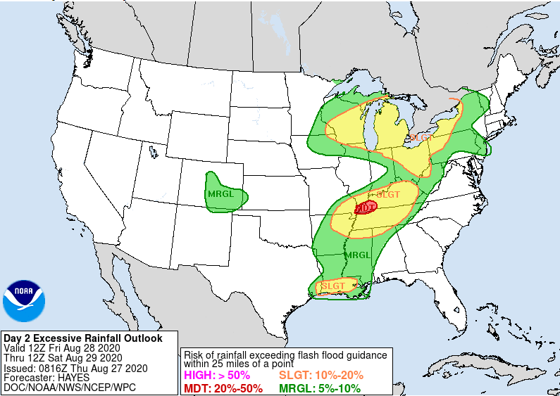
I just want to make a quick note about the weather here in Houston tomorrow. We’ve seen signs on the models that sort of a trailing band of moisture feeding Laura’s remnants will set up over southeast Texas and Louisiana. At this point, we’d just expect scattered thunderstorms across the area on Friday. However, it’s feasible that a slower moving band of heavier rain sets up somewhere near or east of Houston tomorrow and dumps some heavy rainfall.

The Weather Prediction Center has the eastern part of the Houston metro area in a borderline marginal/slight risk of excessive rainfall tomorrow, meaning heavy rain is possible. (NOAA)

The Weather Prediction Center of NOAA has the eastern fringe of the metro area not far from a “slight” risk (Level 2/4) of excessive rainfall Friday. While this is more likely to be directed into Louisiana, it’s entirely possible this sets up closer to Houston. So, we just want you to be aware of the risk of some locally heavy rainfall tomorrow. Thankfully, we didn’t see much of anything during Laura’s passage, so we have a good amount of room to absorb any rains.

As of right now, Eric and I are intending to take tomorrow off as a necessary recovery day. However, if it appears the rain risk will become more significant, we’ll chime in with an update. In the meantime, have yourselves a good evening.

27 Aug 12:20

Comic for 2020.08.26

New Cyanide and Happiness Comic
27 Aug 11:50

Laura roars like a lion into Louisiana, but acts as a lamb in Houston

by Eric Berger

POSTED AT 1 AM CT THURSDAY: At midnight, central time, the northern eyewall of Hurricane Laura came ashore over Cameron Parish, Louisiana. This is about 35 miles east of the state’s border with Texas, and a bit further east than forecasters anticipated. This places the storm’s core of strongest winds solidly over the western half of Louisiana, and should spare much of the Beaumont region from the very worst of Laura. Meanwhile, a devastating storm surge is moving into southern Louisiana and has inundated some locations for dozens of miles inland.

Laura had 150 mph winds at landfall, the hurricane center reported. This makes it a high-end Category 4 hurricane, tying the storm for the fifth most powerful continental U.S. landfalling hurricane since 1900.

The worst of the storm’s winds are only now moving onshore and the hurricane center justifiably urged those who have not evacuated from Southwestern Louisiana to, “Treat these imminent extreme winds as if a tornado was approaching and move immediately to the safe room in your shelter. Take action now to protect your life!”

Local effects

A landfall in Cameron places the storm’s center more than 130 miles from Houston, and because this is further than anticipated we are seeing very limited impacts here in the metro area. There is some moderate surge along the coast and in Galveston Bay, and a few areas have recorded wind gusts near 40 mph. As a result of these lower-than-expected winds, Houston has so far experienced no power outages tonight—a welcome change from our earlier expectations. We do not anticipate winds increasing significantly overnight. Rain chances are quite low as well. This is it, folks.

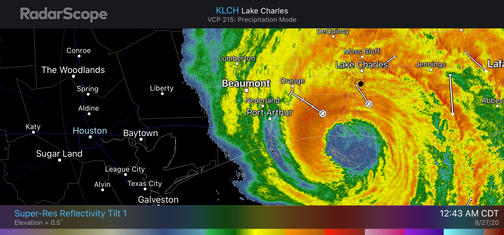
Laura’s rains only extend about as far west as Winnie tonight, and they’re unlikely to get closer. (RadarScope)

Houston will probably be mostly cloudy, and quite warm on Thursday with a drier flow from the north on Laura’s backside. Rain chances may increase on Friday as the tail of Laura brings some moisture into the area before lifting entirely away. We’ll have a complete forecast for Houston in the morning—whenever I wake up.

27 Aug 04:23

Some late night thoughts about Laura, and hurricanes in general

by Eric Berger

I have come to the conclusion that hurricanes are fascinating and horrible. But mostly, horrible.

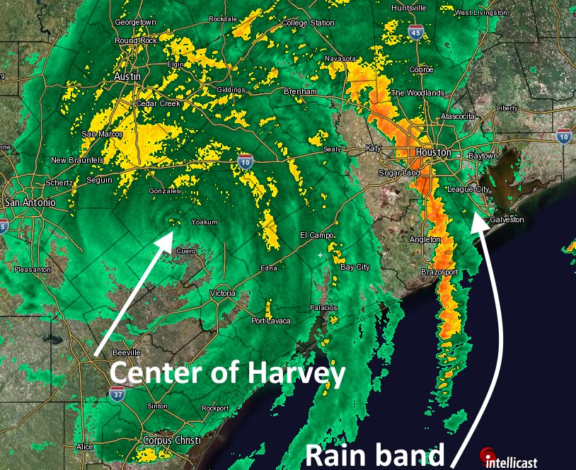
Three years ago, at this very hour, those first, tremendous rain bands from Hurricane Harvey were pushing through Houston. It was a Saturday night. The storm had come ashore the day before, and Houston had seen a few bouts of heavy rainfall on Friday night. Most of the day Saturday was reasonably sedate. And then, BOOM. Ten inches of rain on the west side and then the first band moves over to the east side of Houston. And then it. Just. Stopped. Twelve inches of rain in two hours at one gauge near my home. Like for many of you, that was the longest and worst night of my life. Rising waters. Flooded homes. No idea if it would ever end.

Radar image of Tropical Storm Harvey at 9pm CT August 26, 2017. (Space City Weather/Intellicast)

And now tonight we are watching another devastating hurricane, Laura. This one is a completely different animal from Harvey. Though inland flooding from rainfall is not a concern this is a monstrously intense storm, stronger than anything ever recorded in that part of the Gulf of Mexico, pushing a wall of water toward Louisiana and lashing the state with 150-mph winds. I have never experienced that. I never want to. You run from that hell. And you run fast.

I feel immense relief tonight that Laura is not barreling down on the west end of Galveston Island, bringing 130- or even 140-mph wind gusts across broad swaths of the Houston community and leaving a path of devastation. At the same time, I have something akin to survivor’s guilt knowing that I will sleep comfortably in my bed late tonight. I’ll hear some wind. Maybe some rain. But these will only be distant echoes of the horrors unfolding a couple of hundred miles away, on the beastly right side of Laura. So many will lose so much tonight. Some will pay the ultimate price. Others will see their lives and livelihoods destroyed. So hurricanes are horrible.

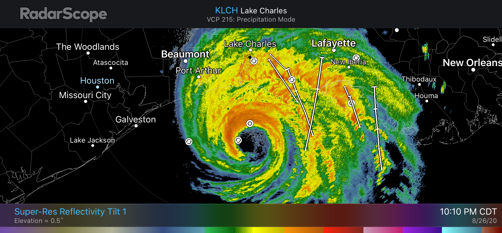
Houston came pretty close to feeling Laura’s wrath. Many people closely watched the radar today, anxious to see whether Laura would in fact turn fully to the northwest, and then the north, as forecast. This gives you some insight the difficulty in forecasting a storm like Laura. As recently as Monday morning—less than three days ago—Laura was still a tropical storm more than 1,500 miles from Houston. The trick was figuring out when that turn to the northwest would occur, and getting it right to within dozens of miles. Because if Laura had waited a few more hours to turn, we all have an idea of what might have happened here.

Hurricane Laura is about 50 miles south of Cameron, Louisiana, at 10:10 pm CT. (RadarScope)

Hopefully this will inspire a younger generation to become interested in meteorology. The reason I got into weather science is because, quite selfishly, I wanted to know what was going to happen. I got caught unawares by Tropical Storm Allison way back in 2001, surrounded by rising waters beneath sheets of torrential rainfall. Never again, I vowed. But forecasting is hard work. Especially as Matt and I have, improbably, found ourselves with a voice in the community. A lot of people, and my goodness there are a lot of you kind souls, in this area now look to us for guidance. That’s a lot of pressure not to screw up. We do sometimes, but we try our damnedest not to, all day and pretty late into the night. But we want to make sure you’re never caught unawares, either. Anyway, it’s now been 11 days since we first started talking about the systems that would become Marco and Laura. It is good to be finally seeing them head toward the exits. We’re exhausted—mentally and emotionally.

We’ll be back with one more post tonight to wrap up conditions for the greater Houston area (they’re not going to be serious at all), and assess some of the preliminary effects of Laura on Louisiana and southeast Texas. That probably will be posted around 2 am CT.

27 Aug 01:30

The Sun and The Moon.

by Cat Hoarder Comics