Shared posts

10 Mar 12:52

Outdoor Swinging Lounge

Now this chair looks mighty comfortable. Miiiiighty comfortable indeed. And I think I might feel just as comfortable watching that mighty cute brunette swinging in it on a breezy summer day as I would be taking a turn rocking on the patio myself. Ahhhh, loungers. Rocking. Summer. Brunettes.

The Thompson Outdoor Swinging Lounge dangles a cozy nest of thick meshed wicker from its powder-coated aluminum stand, and then throws on a coupla cushions to guarantee your back and butt are as content as your reclined legs and swaying whole self. The top of the chair even arcs over the top of your head to provide shade and a little extra privacy.

Chill-Out Score: 10 / 10.

Swinging Lounge materials and fabrics are made for all-weather use. Some (Thompson says "easy") assembly is required, and all tools and instructions for it are included in the box. Frame dimensions are 37-1/2" deep x 37-1/2" wide x 77-3/4" high; swing dimensions are 37-1/2" deep x 28" wide x 56" high.

09 Mar 21:24

Maybe we could tone down the JavaScript / fuzzy notepad

Maybe we could tone down the JavaScript / fuzzy notepad:

Accept that sometimes, or for some people, your JavaScript will not work. Put some thought into what that means. Err on the side of basing your work on existing HTML mechanisms whenever you can. Maybe one day a year, get your whole dev team to disable JavaScript and try using your site. Commence weeping.

09 Mar 21:23

March 9th, 2016 - /r/EvilBuildings: Buildings that look like they or the people inside are up to something

by /u/Respectfullyyours

/r/EvilBuildings

9,168 arch-nemeses for 21 days

As a mod for /r/brutalism, I have an appreciation for big, concrete, intimidating building. Buildings that loom in our urban environment,
often in a uneasy way. Therefore I was excited when I saw the young subreddit /r/evilbuildings pop up on /r/trendingsubreddits a couple of weeks earlier. A subreddit dedicated to buildings where an evil villain might live or work contemplating the demise of the world. Or maybe where an evil corporation plots a devious takeover, or maybe it's just a place where creepy things happen, or it's a little frightening to walk by for some reason. For example, the
Ryugyong Hotel in Pyongyang in North Korea looms above all buildings around it. It's lack of clear windows and it's futuristic style makes one think that the bald-headed Dr. Evil resides in the very top, surveying his kingdom and resting his hand on a button that will lead to the destruction of the world as we know it.

The
black cathedral in Clermont Ferrand, France takes a different approach towards evil. Though it's a religious building, the dark colour contrasted against the light buildings against it creates an incredibly foreboding look. On the complete other side of the spectrum you have a building like
Mussolini's Fascist Party Headquarters in 1930 where it's less that classical style of the building itself that seems evil but the disembodied watching face scowling at you from the front of the building. I love how "evil buildings" can be found everywhere
like ths AT&T Building in Nashville or Buffalo's

City Court Building. And they aren't limited to one achitectural style
as we see with Taipei 101 Tower compared to this

ruin of a house.

Take a moment to look around your own city and think about what nefarious things might be going on in the evil buildings around you. I'm sure you can think of a number of buildings you pass on your daily strolls that have given you ominous feelings and might be worthy of adding to the subreddit.

1. Tell us about yourself! (interests, hopes and dreams, the kind of person you are, anything!)

/u/rudral: i'm Fred, 26 italian guy, writing my master's degree thesis in philosophy [phenomenology and mind/body problem]. I have too many interests, i'm a bit strange and moody, but i think.. in a good way ehe. I have way too many hopes and dreams but i'm still learning how to manage them somehow. hey, that's life.

2. How did you get involved in /r/evilbuildings? What was the inspiration behind the creation of the subreddit?

/u/rudral: i wrote this comment in reply to malgoya's post.. and here we are! I sincerely wasn't prepared for that kind of karma shower! I like nature and in some ways i despise some of the urban jungle that has been made in the recent times.. Indeed /r/brutalism is fascinating, i should say "the most ugly thing oddly starts to become quite fascinating in it's own way!".

3. What are some buildings you've visited yourself that you found particularly evil looking?

/u/rudral: i made a post in our sub about the palace of justice of padua.. that place always reeked of austerity and evil harsh justice! i'm more attracted to the "abandoned eerie and creepy" kind of buildings.. even better if lost inside overgrown forests.. but some towers posted recently here are truly.. well. evil, authoritative, austere. Fascinating too.

4. Have you learned anything in particular during your time moderating this subreddit?

/u/rudral: about modding? well... as plato wrote on socrates, I know nothing except the fact of my ignorance. learning curve from now on it is!

5. Is there anything you think outsiders to this subreddit should know about /r/evilbuildings?

/u/rudral: Evil looking is not just about architecture or materials.. think! would an evil mastermind choose this place? why so? [for example, when i was a kid i invented stories about evil mages masterminds ruling the world from the top of a local church in padua - Saint justine's domes
here and
here]

submitted by /u/Respectfullyyours
[link] [comments]
09 Mar 20:53

Google introduces Destinations to simplify trip planning

by Nick Sarafolean

Google is a company that’s constantly working to make things easier, simpler and more intuitive for its customers. Today, Google is taking the wraps off of its latest creation, Destinations on Google. Destinations is a new feature of Google Search that aims to simplify trip planning, allowing you to take advantage of a simple, straightforward planning process right from within Google Search, saving you the hassle of switching between tabs to compare different info.

Destinations is simple enough to utilize: just add the word “destination” to your search for a travel spot. By using that keyword, Google will instantly combine the information gathered from Google Search, Google Flights and Hotel Search to provide you with a comprehensive way to plan your trip.

You can also search for activities at your destination, and Google will provide the best results that tie into when and where you’re looking to go. To aid in the when question, Google is offering a flexible dates filter, which allows you to look at prices and activities over a range of dates, without choosing the exact dates that you’ll be at your destination. You can also tap on the Explore Tab within destinations, which will inform you of the usual weather and the level of business during your selected date range.

Once you’ve decided on a destination, you can tap on Plan a Trip, which will show the highs and lows of trip planning over the next six months. As you slide left and right over the date range, Google will show you an estimated price for your trip and will instantly update the price to match real-time fares and rates, all based off of the data that the company handles through Google Flights and Hotel Search. Users can further customize the results through a number of variables, such as flights with or without stops, hotel class, and more.

To cap it all off, Destinations can help you find the best things to do while you’re on your trip. Simply type in your destination’s name plus the word travel and it’ll bring up the best suggestions based on past itineraries by users. It’ll also take into account the time of year that you’ll be traveling and keep that in mind when providing you with results.

Destinations is a fantastic new tool from Google that’s going to make travel planning far easier for many. For more info and .GIFs of all the features in action, just follow the source link below.

09 Mar 20:19

Photo


09 Mar 17:36

Euphemism Creep in Hebrew.

by languagehat

Elon Gilad in Haaretz has a piece called “Why Hebrew Has So Many Words for ‘Penis’” (if that link takes you to a paywall, google the title and use the cached version) that provides some fine, and salacious, language history:

Euphemism creep didn’t start yesterday. The Bible is replete with circumlocutions for penis, to the extent that it isn’t clear what the actual word for penis was in ancient Israel.

Biblical allusions include basar (“flesh”, Exodus 28:42), erva (“nakedness”, Leviticus 18:6), mevoshim (“private parts”, Deuteronomy 25:11), regel (“leg”, 2 Kings 18:27), shofkha (“spout”, Deuteronomy 23:1), yad (“Hand”, Isaiah 57:8), and me’or (“Nakedness”, Habakkuk 2:15).

Later, during the times of the Mishnah and the Talmud (the first six centuries of the Common Era), the rabbis added some more euphemisms to those of eld: panim shel mata (“lower face”, Shabbat 41a), ama (“middle finger”, Shabbat 108b), etzba (“finger”, Pesachim 112b), shamash (“helper”, Nidah 60b), gevia (“corpse”, Negaim 6:7), parmashtaq (probably a Persian word for “penis”, Mo’ed Katan 18a), and evar (“organ”, Bava Mezia 84a).

In the Middle Ages, even though Hebrew had ceased to be a spoken language, rabbis kept up the pace. New names of the era included: brit (“covenant” – referring to circumcision), gevura (“manliness”), geed (“tendon”), zakhrut (“maleness”), zanav (“tail”) and kama (“ripe sheaf”).

With such an abundance of suggestions at their disposal, and these lists are not exhaustive, you would think that when Hebrew was reborn as a spoken language starting in the late 19th century, the new Hebrew speakers – preoccupied with finding words for the modern world – would settle for the rich pickings from previous generations of Jews over millennia. Not so. New words had to be found.

An early “modern” word for penis, zereg, was first noticed among giggling children at Tel Aviv’s Gymnasia Herzliya school in the early 20th century. It may have been a corruption of gezer (“carrot”) or zerek (“hose” – defunct).

Another word springing from the classrooms of early Tel-Aviv is zayin, which is by far the most common used word for penis in contemporary Hebrew, though – you stand warned – it is considered vulgar.

There is discussion of various proposed etymologies for zayin and the Yiddishisms shmock and shtrungool (the latter apparently a Hebrew corruption of strunckel ‘little (tree) trunk’); then we get this delightful passage:

The polite, “official” word for penis is peen, and it comes from an ancient typographical error.

The Mishnah, a treatise on Jewish law written in roughly 200 CE, has a passage that reads “A key of metal with pins of wood is pure” (Kelim 13:6). The word for pins here is khapeen. But sometime over the generations, a scribe made a mistake, replacing the first letter, khet (ח), with the nearly identical looking hei (ה). From “khapeen” – pins, plural, the word was mistakenly rendered as “hapeen,” the pin.

In modern Hebrew too, pin came to be peen. And when Hebrew revivers were looking for a word for penis, they decided peen would do for that too. It was reminiscent of penis and pins sort of look like tiny penises.

This actually caught on. But in the 1950s, the Hebrew Language Academy chose not peen but evar (“organ”) as the official word for penis, or evar meen – “sex organ”.

People did indeed take to saying evar meen, which was used for both male and female naughty parts, but in writing the word remained peen. Then in 2009, the academy caved in to the public and made peen the official word. But although it was the will of the people and it’s official to boot –it’s rarely used when speaking any more. It’s considered too prissy.

Thanks, Kobi!

08 Mar 21:07

Google Play Days sale drops prices on apps, music, movies and books

by Sean Riley
Dan Jones

American Idiot for only 99¢. Some nice photo editing apps for cheap.

Google is running an impressive sale right now across all of Google Play with some solid deals on apps, music, movies and books. Some of the deepest discounts can be found on apps, with a total of 28 apps all available for 99 cents, including some typically pricey audio software from DJiT and a host of other apps and games.

The music offerings similarly feature a number of albums discounted to just 99 cents and dozens of others on sale for between $7 to $9.

There are a couple separate deals running on movies in Google Play, depending on whether you are looking to rent or buy. The Play Days sale is focused on purchases and has several titles at almost 50% off. If you are just looking to rent, you can still snag 50% off a single rental of any movie before March 17th.

The Play Books deal is pretty interesting this time around, as it is just giving you an extended preview on a few dozen books, meaning that you can read up to 50% of the book before you need to decide if you want to make a purchase. Take a look at the titles and if you find anything that piques your interest get started for free.

That’s a lot of deals to sort through, so if you see any of your personal favorites on sale across any of the categories, we’d love to hear about them.

08 Mar 16:35

Top 10 movie plot twists of all time

by Jason Kottke

There are spoilers galore in Cinefix's look at the best ever plot twists in movies, sorted into categories including It Was All a Dream, Not Dead, and Unexpectedly Bad.

Tags: best of   lists   movies   video
08 Mar 15:21

my life is a thrilling one BUY MY BOOK - Patreon- Facebook -...


my life is a thrilling one

BUY MY BOOK - Patreon- Facebook - Twitter - Subreddit

08 Mar 15:05

A brand new look for future Kodi versions

by Martijn

A long, long time ago when Kodi was still called XBMC, a new skin came into life. It was on 21 November 2009 that the switch was made from PM3.HD to Confluence. Over the years it has fulfilled it’s purpose as the default skin which every one sees on a fresh Kodi installation and many likely never switched to one of the other skins available. During this period Confluence received several minor tweaks and updates and only one big change when we switched from a vertical to horizontal main menu.

Today will mark a new milestone in the history of the project as we announce our two new default skins. Yes you read it correct, two new skins. The first one is called Estuary and it will be what most of you will see from now as it is designed for the so-called “10 foot media center experience”. The second one is dedicated to the people who are using touchscreens and is called Estouchy which will be replacing the re-Touched skin.

Many months of hard work have been put into these two new skins as that’s how long it takes to build a new skin from the ground up. Mainly team members Phil65, Piers and ronie have been working in secret creating these brand new beautiful skins that will become the new look and feel for Kodi. Build from the ground up with the main focus on using the latest features in the best way possible. Additionally they had a lot help of some core developers on getting the needed changes done to Kodi and the rest of the team for getting most of the testing done.
Both skins are installed by default and most users will start with Estuary while iOS users will start with Estouchy.

Without further ado let’s take a tour through both new skins guided by some screenshots and YouTube video.

Estuary

As you will see the main eye catcher is the whole new home screen which will guide you through all the main sections that are available. All this build from some of the newest features that are available for skin creators. We have added some useful widgets for movies and tv shows like random, recently added, in progress and, random. For music recently played, added, random, unplayed and most played are available. Even Live TV has a favourite channels widget.

Themes TV Shows
 Albums  Video add-ons
 Video sources  Weather

For add-ons a new feature was added that will show you the add-ons for each media type sorted by last used directly on home screen. By doing so the add-ons you use most are always within reach. The top bar has some useful shortcuts that will jump straight to what we felt was most useful.

Library and onwards

Entering the library you will notice that all views also received some facelift. The developers tried to keep functionality and information in balance and certainly did a great job.

Movies Movies
TV Shows TV Shows
Music Albums
Albums Live TV
Live TV Video add-ons
Add-on browser Settings

Themes and colours

As a bonus we added a whole variety of themes and colours to change the look a bit more. Although not really new feature we never really used it in the default skin until now. The examples below are some of the available themes that are included by default. After you changed to a certain theme you can still change certain highlights with changing the colour option below the theme setting. We hope that by including these variations there will be something to each her or her liking. More are likely to follow in the near future.

Estuary: Themes Estuary: Themes


Estouchy

Creating a functional and good looking skin for small screen touch devices is quite challenging. With Estouchy this balance seems to hit a nice sweet spot and ronie did a great job on this. As many have noticed there isn’t really a touch friendly skin available so we’re certainly happy to offer a good compromise for this by default.

Estouchy: Main menu Estouchy: Settings
Estouchy: Albums Estouchy: Albums
Estouchy: Albums Estouchy: Music
Estouchy: TV Shows Estouchy: TV Shows
Estouchy: TV Shows Estouchy: Movies
Estouchy: Movies Estouchy: Live TV

As you notice not all the features Estuary has are available on Estouchy. The main reason is that the screen is simply not big enough to fit everything on it and remain usable.

We would mainly like to say thanks to Phil65, Piers and ronie whoe create the skin as well as all team members who put a lot time and effort in these two new skins that resulted in these magnificent creations. We hope everyone enjoy them for years to come.

Video walkthrough

Nothing better than actually seeing these skins in action so we put up some videos to give you a sneak preview for what is to come.

Estuary Trailer

Estuary walk through (22 minutes)

Estouchy walk through


Bug reports and suggestions

Although we already did some extensive testing ourselves there will always be some minor bugs and glitches presents so we if you find any please report them in the forum threads listed below. Make sure you add enough information or screenshots so we can reproduce. We’re sure many of you will have suggestions to make Estuary and Estouchy even better so we’d love to hear them. Do note that we want to keep the default skins as simple and easy to use as possible so we will not start adding every customization or feature that comes up. Please understand our point of view on this. For Estuary forum section you can go here and for Estouchy can go here.

Conclusion

We certainly hope that with these two new skin we pushed Kodi to a new level of first user friendliness and help them get a easier start on the world of Kodi. During the coming months we will further tweaks and polish these skins to iron out any issues and incorporate and improve features we would think users will benefit from. Sadly we cannot please everyone and some of you might not like these skins. Please understand we tried to do our best to fit the most common use cases and will not add advanced customization that the more knowledgeable people want. For them there is an abundance of other skins available that do offer all bells and whistles.

If you wonder when they will be available we can say from this day forward. However for this you will need to install our Kodi v17 nightly builds which you can find at the bottom of our download page. Do note that these are not meant for daily use unless you are really adventurous.

Estuary and Estouchy are only meant to be installed in Kodi v17 “Krypton”  versions. They will NOT function properly in any previous Kodi version. By default a new install will only have Estuary and Estouchy installed. Since Confluence will still be available from our official repository any existing Kodi installation that upgrades to v17 “Krypton” will receive the updated version of Confluence. We can imagine that not everyone would like to be forced to switch to the new skin so we came to this solution.


07 Mar 22:23

Photo


07 Mar 17:54

Conditionals

'If you're done being pedantic, we should get dinner.' 'You did it again!' 'No, I didn't.'
07 Mar 17:37

Old.

by B_Movie_Guy
I honestly can't remember if that show was any good or not. I remember watching it all the time, but I don't remember if I liked it.

Love,
   Chris.
Facebook.com/PoorlyDrawnThoughts
Twitter: @poorlyDrawnGuy
07 Mar 17:37

Don’t misclick.image / twitter / facebook / patreon


Don’t misclick.

image / twitter / facebook / patreon

07 Mar 12:41

@someecards #NeverTrump http://ift.tt/1U5ztO7


@someecards #NeverTrump http://ift.tt/1U5ztO7

07 Mar 03:44

Terrifying

by Lunarbaboon

07 Mar 03:44

X-Men Superheroes as Color Kids from Rainbow Brite

X-Men Superheroes as Color Kids from Rainbow Brite


This has to be one of the most fun and creative mashups we've seen yet! The artists over at Rage Gear Studios put together this wonderful fan art series of characters from X-Men as Color Kids from the beloved classic animated series Rainbow Brite! We'd absolutely love to see some cosplays of this! ♥

X-Men Superheroes as Color Kids from Rainbow Brite

X-Men Superheroes as Color Kids from Rainbow Brite

X-Men Superheroes as Color Kids from Rainbow Brite

X-Men Superheroes as Color Kids from Rainbow Brite

X-Men Superheroes as Color Kids from Rainbow Brite

X-Men Superheroes as Color Kids from Rainbow Brite

X-Men Superheroes as Color Kids from Rainbow Brite

X-Men Superheroes as Color Kids from Rainbow Brite

X-Men Superheroes as Color Kids from Rainbow Brite

X-Men Superheroes as Color Kids from Rainbow Brite

X-Men Superheroes as Color Kids from Rainbow Brite

Artist: Rage Gear Studios

Follow us on:
 

March 06 2016
07 Mar 03:39

Create Columns Easily with CSS3's Column-Count

Create Columns Easily with CSS3's Column-Count:

CSS3’s column-count property makes it easy for you to turn your content into columns with only one line of CSS and no extra HTML markup.

If you want to spread that content out across three adjacent columns, you can do it manually by creating three divs and styling them to float or display inline, OR you can use CSS3’s column-count property, like this:

div{
  -webkit-column-count: 3;
}
06 Mar 15:18

While discussing the internet...

by MRTIM

06 Mar 00:25

While discussing politics...

by MRTIM

06 Mar 00:25

Dentist

by Reza
Dan Jones

Why does the dentist make me lie to him?

dentist

06 Mar 00:25

Google Play Free Song of the Day 3/04/2016

by MumbleBee
Dan Jones

Although, I'm guessing most of you who would be interested in this, already own this album.

Linkin Park

Click image to enter!


Hybrid Theory (Entire Album)

By

Linkin Park


About the artist

Hybrid Theory is the debut album by the American rock band Linkin Park, released on October 24, 2000 through Warner Bros. Records. The album was a commercial success, having been certified Diamond for sales of over 10 million units in the United States alone as of 2010, peaking at number two on the Billboard 200, and also reaching high positions on other charts worldwide.
Recorded at NRG Recordings in North Hollywood, California, and produced by Don Gilmore, the album’s lyrical themes deal with problems lead vocalist Chester Bennington experienced during his adolescence, including drug abuse and the constant fighting and divorce of his parents. Hybrid Theory takes its title from the previous name of the band as well as the concept of music theory and combining different styles.
Four singles were released from the album: “One Step Closer”, “Crawling”, “Papercut”, and “In the End”, all of them being responsible for launching Linkin Park into mainstream popularity. While “In the End” was the most successful of the four, all of the singles in the album remain some of the band’s most successful songs to date.

Description provided by Wikipedia under Creative Commons Attribution CC-BY-SA 4.0


They may ask for credit card information through Google Play, but it is 100% completely FREE and you will not be charged!


 Capture

ADDITIONAL INFORMATION

Genres
Alternative/Indie/Alt Metal/Rock
Tracks
12
Released
October 24, 2000
Label
© 2000 Warner Bros.
File type
MP3
Access type
Streaming and by permanent download to your computer and/or device
Internet connection
Required for streaming and downloading
Playback information
Via Google Play Music app on Android v4+, iOS v7+, or by exporting MP3 files to your computer and playing on any MP3 compatible music player

05 Mar 19:39

How Female Computers Mapped The Universe And Brought America To The Moon

The group of women computers at the Harvard College Observatory, who worked for the astronomer Edward Charles Pickering, c. 1890. (Photo: Harvard College Observatory/Public Domain)

At Harvard Observatory in the late 1800s, the hum of over a dozen computers buzzed from the busy astronomy calculation room. Devising complex calculations to map the stars, the computers worked in skirts and corsets, gripping their pencils at thick wooden desks. If you haven’t guessed, these computers were not the sort we think of today, but were teams of people using arithmetic to transform raw observational data into a useable form.

Harvard’s female computers, sitting in a small room with floral wallpaper, surrounded by stacks of papers and star charts, not only advanced the field of astronomy, but created new systems to study the stars that are still used today—though the women themselves largely worked behind the scenes, a trend that continued throughout the 19th century and into the space age.

Unfortunately, the women at Harvard (these days called the “Harvard Computers”), were not exactly recognized for their individual contributions to mathematics and astronomy. At the time, they were known colloquially as “Pickering’s Harem,” and it was believed that the computing work they were doing was akin to the tedium of embroidery. 

A photo from 1913 showing the female Harvard computers with Edward Charles Pickering. (Photo: Harvard-Smithsonian Center for Astrophysics/Public Domain)

If calling these female professionals a "harem" sets off a red flag for misogyny, you’d be onto something; their hire was characterized by the ironic mix of sexism and opportunity that defined late 19th-century progressivism. While men were also employed as computers for various mathematical tasks, clerical work (barred to women before the Civil War) had begun to be viewed as "women’s work"–even when it involved intricate calculations, cataloguing, and data analysis. Many of the male scientists of the era would never have guessed that the “busywork” they handed to female computers in the late 1800s would go on to become so important. 

In the 19th century, Harvard Observatory was one of the most prominent astronomical studies centers of the United States, but the institution had a bit of a data problem: there was too much of it to handle. David Alan Grier writes in When Computers Were Human that a “decade of numbers” was left behind by a former astronomer, Joseph Winlock, who apparently loved recording the information without putting it into any usable or practical form.

With the data for thousands of observations recorded by men with telescopes, the observatory had to act. Edward Pickering, the director of the observatory, employed a male assistant, but disliked his work ethic and cataloguing skills. In 1881, he decided to turn to someone close to him who he thought would produce more thorough clerical work: his housemaid, Williamina Fleming.  

Wilhelmina Fleming circa 1890s. (Photo: Courtesy Curator of Astronomical Photographs at Harvard College Observatory/Public Domain

Pickering, who was seen as a liberal progressive, thought hiring Fleming as a “computer,” to catalogue the data and do all the tedious work the men couldn’t be bothered to do, seemed like a good bet. Hired at a mere 25 to 50 cents an hour, not only were women like Fleming getting the job done, but they were saving the observatory a fair bit of money.

Grier writes the women’s rate was half that normally paid for calculation work—cheap labor that made other observatories jealous as Pickering wrote that “a skillful observer should never be obliged to spend time on what could be done equally well by an assistant at a much lower salary.”

As archaic as that sounds now, at the time Harvard Observatory was one of the only options in the area for a female mathematician to apply her skills. Women’s colleges existed, but assumed graduates would get married rather than start a career; female graduates were eager to use their mathematical knowledge for real-world use.

Fleming, whose prior gig as a housemaid paid less than the academic work, jumped at the chance—and luckily so for future astronomers; the Harvard Observatory would go on to become an incubator for the skills of brilliant women. Over her 36-year career at the Harvard Observatory, Fleming not only discovered and catalogued over 10,000 stars, several nebulae, and the existence of white dwarf stars, she also oversaw more than 80 other female computers, many of whom came straight from college or high school. 

Harvard College Observatory, c. 1900. (Photo: Library of Congress/LC-DIG-det-4a08545)

One of her employees, Henrietta Swan Leavitt, discovered a logarithm for the relationship between the luminosity of stars and their distance from one another, a method that let astronomers measure our proximity to other galaxies. Another, Annie Jump Cannon, a mathematics and astronomy graduate of Wellesley College in Massachusetts, brought new knowledge of interactions of light, matter and radiation through her interest in spectroscopic astronomy.

Over the course of four years Cannon and her colleagues methodically studied thousands of photographic plates of the night sky for the Henry Draper Catalogue, a massive data collection project published from 1918 to 1924, that aimed to map every star that could be photographed at the time (and contributed to her staggering classification of over 500,000 stars).

By the time the catalogue was published, Cannon had invented the Harvard classification system, which orders star types based on their brightness and size. We still use it today: astronomy students memorize the letters O, B, A, F, G, K, M (known by the mnemonic “Oh Be a Fine Girl, Kiss Me“).

Stars were, for the first time, catalogued by one of their most telling qualities: size. Knowing a star’s size can help calculate its age and temperature. Not only did this system distinguish one star from the next, it helped lay out the possibilities those stars told of its surrounding universe: how far it was from earth, what planets could orbit it around its mass, when it might explode.

Annie Jump Cannon and Henrietta Swan Leavitt, 1913. (Photo: Harvard University Library/Public Domain)

This trend for women to do the computational work of astronomy continued into the 20th century. In 1935, five women joined the predecessor of NASA, National Advisory Committee for Aeronautics (NACA) as computers, and, NASA reports, became “essential to operations at the center“, and more efficient than the male engineers. After the shortage of male workers following World War II, the Langley Research Center in Virginia of NACA employed hundreds of female computers who, like their Harvard predecessors, advanced astronomical knowledge.

In the segregated west end of the facility of NACA, a new research team of black women emerged, known as the West Area Computers, who ultimately drove the success of the early flight and space research program. When NACA became NASA in 1958, and the space program took priority, they again needed extra help, and yes, that meant looking toward female computers to provide the complex calculations required for space flight. 

Once again the door for women in the sciences opened as Katherine Johnson, a mathematical child prodigy who graduated from college at age 18, responded to that call. Born the same year Harvard Observatory Computers were scratching pencils and studying photographs of the night sky in 1918, she joined their historic ranks as one of the most important mathematicians in the astronomy field in the U.S. Wini Warren writes in Black Women Scientists in the United States that Johnson was “loaned out to the Flight Research Division and never sent back” for her recognized genius.

She calculated the trajectory of the first American in space, and her calculations even guided the spacecraft of Neil Armstrong and Buzz Aldrin safely through the first moon mission of Apollo 11. According to NASA, even when the electronic computers we use today became popular, John Glenn “requested that she personally recheck the calculations made by the new electronic computers before his flight aboard Friendship 7—the mission on which he became the first American to orbit the Earth.”

Katherine Johnson sits at her desk with a globe, or "Celestial Training Device", at NASA. (Photo: NASA/Public Domain)

Women like Johnson are now getting some much-warranted credit for their work; Margot Shetterly will explore the histories of the black women of the West Area Computer team in her book Hidden Figures: The Story of the African-American Women Who Helped Win the Space Race, set to come out this year. While most of the female Harvard Computers didn’t get the recognition they deserved during their lifetimes, they certainly helped forge the way for women in science.

Today, statistics show that the sciences are still held away from women, with female scientists explaining that the same prejudices that kept women from the engineer’s room in the 1800s and 1940s keep them from these occupations today. But fortunately that isn’t keeping women from breaking through the glass ceiling of the observatory room; programs and mentors for women in science and math are growing.

As more women enter the fray, it’s worth celebrating the women of the past who proved, through intelligence and capability, that their successes are as long-lasting as the sciences themselves. Johnson said in her speech at a NASA conference in 2010, "Some things will drop out of the public eye and will go away, but there will always be science, engineering and technology," and not least of all the brilliant female computers who mastered complex calculations many decades before electronic computers had even been invented. 

05 Mar 19:07

Watch Cospaint Master Kay Pike Transform Herself Into Poison Ivy

by Stefan A. Slater

hot-damn-this-poison-ivy-body-paint-cosplay-is-stunning-872488

Sure, Kay Pike’s Poison Ivy body paint cosplay is impressive. Everything she does is impressive.

I can only imagine how much work and effort went into making this incredible cospaint. Oh wait, I can watch the time lapse video of the process below!

hot-damn-this-poison-ivy-body-paint-cosplay-is-stunning-872489

hot-damn-this-poison-ivy-body-paint-cosplay-is-stunning-872491

(via Moviepilot)

04 Mar 20:31

Texas Isn't Ready For The Next Big Hurricane

Dan Jones

I don't like what I'm reading.

Return to Map

It is not if, but when Houston’s perfect storm will hit…

They called Ike “the monster hurricane.”

Hundreds of miles wide. Winds at more than 100 mph. And — deadliest of all — the power to push a massive wall of water into the upper Texas coast, killing thousands and shutting down a major international port and industrial hub.

That was what scientists, public officials, economists and weather forecasters thought they were dealing with on Sept. 11, 2008, as Hurricane Ike barreled toward Houston, the fourth-largest city in the United States and home to its largest refining and petrochemical complex. And so at 8:19 p.m., the National Weather Service issued an unusually dire warning.

“ALL NEIGHBORHOODS, AND POSSIBLY ENTIRE COASTAL COMMUNITIES, WILL BE INUNDATED,” the alert read. “PERSONS NOT HEEDING EVACUATION ORDERS IN SINGLE FAMILY ONE OR TWO STORY HOMES WILL FACE CERTAIN DEATH.”

But in the wee hours of Sept. 13, just 50 miles offshore, Ike shifted course. The wall of water the storm was projected to push into the Houston area was far smaller than predicted — though still large enough to cause $30 billion in damage and kill at least 74 people in Texas. Ike remains the nation’s third-costliest hurricane after Katrina and Superstorm Sandy.

Still, scientists say, Houston’s perfect storm is coming — and it’s not a matter of if but when. The city has dodged it for decades, but the likelihood it will happen in any given year is nothing to scoff at; it’s much higher than your chance of dying in a car crash or in a firearm assault, and 2,400 times as high as your chance of being struck by lightning.

If a storm hits the region in the right spot, “it’s going to kill America’s economy,” said Pete Olson, a Republican congressman from Sugar Land, a Houston suburb.

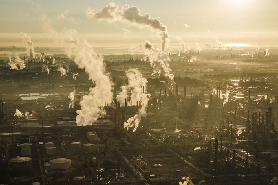
Such a storm would devastate the Houston Ship Channel, shuttering one of the world’s busiest shipping lanes. Flanked by 10 major refineries — including the nation’s largest — and dozens of chemical manufacturing plants, the Ship Channel is a crucial transportation route for crude oil and other key products, such as plastics and pesticides. A shutdown could lead to a spike in gasoline prices and many consumer goods — everything from car tires to cell phone parts to prescription pills.

Explore the Ship Channel »

“It would affect supply chains across the U.S., it would probably affect factories and plants in every major metropolitan area in the U.S.,” said Patrick Jankowski, vice president for research at the Greater Houston Partnership, Houston’s chamber of commerce.

Houston’s perfect storm would virtually wipe out the Clear Lake area, home to some of the fastest-growing communities in the United States and to the Johnson Space Center, the headquarters for NASA’s human spaceflight operation. Hundreds of thousands of homes and businesses there would be severely flooded.

Many hoped Ike’s near miss would spur action to protect the region. Scientists created elaborate computer models depicting what Ike could have been, as well as the damage that could be wrought by a variety of other potent hurricanes, showing — down to the specific neighborhood and industrial plant — how bad things could get.

Play Hurricane Ike

They wanted the public to become better educated about the enormous danger they were facing; a discussion could be had about smarter, more sustainable growth in a region with a skyrocketing population. After decades of inaction, they hoped that a plan to build a storm surge protection system could finally move forward.

Several proposals have been discussed. One, dubbed the “Ike Dike,” calls for massive floodgates at the entrance to Galveston Bay to block storm surge from entering the region. That has since evolved into a more expansive concept called the “coastal spine.” Another proposal, called the “mid-bay” gate, would place a floodgate closer to Houston’s industrial complex.

But none have gotten much past the talking stage.

Hopes for swift, decisive action have foundered as scientists, local officials and politicians have argued and pointed fingers at one another. Only in the past two years have studies launched to determine how best to proceed.  

A devastating storm could hit the region long before any action is taken.

“That keeps me up at night,” said George P. Bush, the grandson and nephew of two U.S. presidents and Texas’ land commissioner. As head of an agency charged with protecting the state’s coast, he kickstarted one of the studies that will determine the risk the area faces and how to protect it.

But the process will take years. Bush said, “You and me may not even see the completion of this project in our lifetime.”

It’s already been eight years since Ike and Houston gets hit by a major storm every 15 years on average.

“We’re sitting ducks. We’ve done nothing.” said Phil Bedient, an engineering professor at Rice University and co-director of the Storm Surge Prediction, Education, and Evacuation from Disasters (SSPEED) Center. “We’ve done nothing to shore up the coastline, to add resiliency ... to do anything.”

Shell's Deer Park facility is just one of the many industrial facilities that sit on or near the Houston Ship Channel, one of the world’s busiest shipping lanes. (Edmund D. Fountain/ProPublica/Texas Tribune)

To this day, some public officials seem content to play the odds and hope for the best. Houston’s new mayor, former long­time state lawmaker Sylvester Turner, declined an interview request for this story. Turner’s office released a statement from Dennis Storemski, the city’s public safety and homeland security director.

“Only a small portion of the city of Houston is at risk for major storm surge,” it said. In a second statement, Storemski placed the onus primarily on the federal government to safeguard the Houston region from a monster hurricane. He said the city “looks forward to working with the responsible federal agencies when a solution is identified and funded.”

“Until then, we continue to inform our residents of their risk and the steps they should take when a significant tropical cyclone causes storm surge in the [Ship] Channel, and evacuations become necessary,” the statement said.

The pressure to act has only grown since Ike, as the risks in and around Houston have increased.

The petrochemical complex has expanded by tens of billions of dollars. About a million more people have moved into the region, meaning there are more residents to protect and evacuate.

“People are rushing to the coast, and the seas are rising to meet them,” said Bill Merrell, a marine scientist at Texas A&M University at Galveston.

”We’re all at risk”

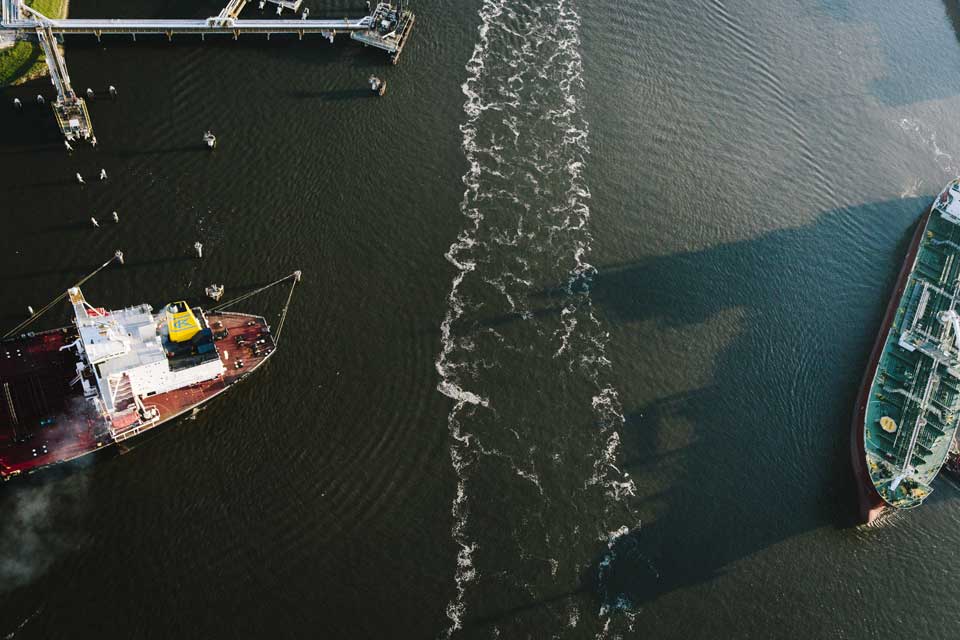
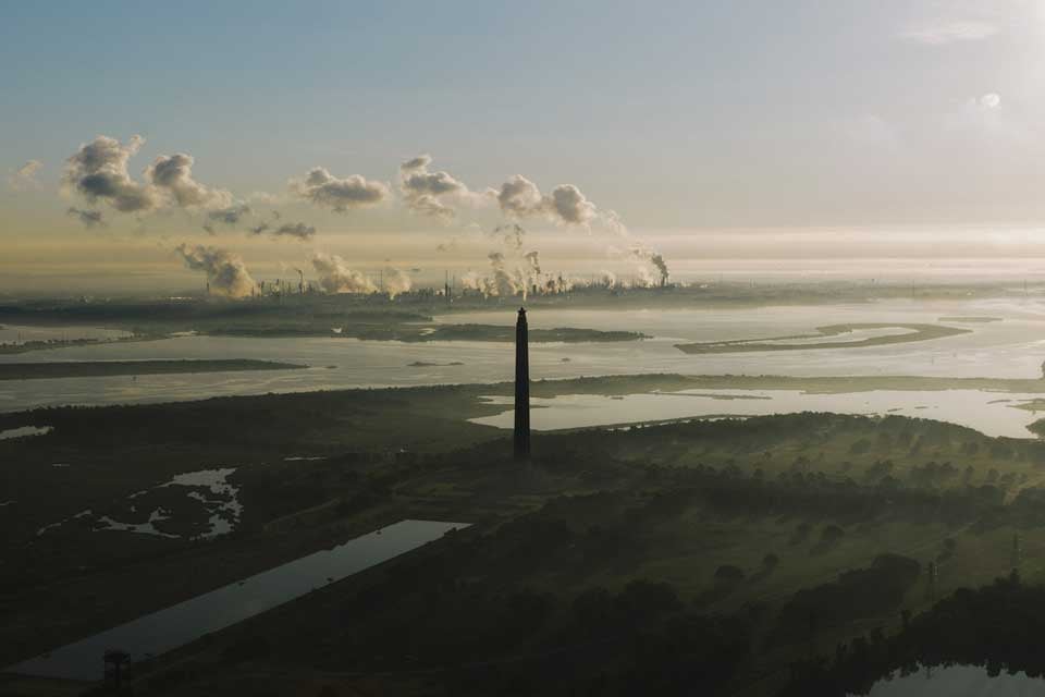
The Houston Ship Channel and the energy-related businesses that line it are widely described as irreplaceable. The 52-mile waterway connects Houston’s massive refining and petrochemical complex to the Gulf of Mexico.

For all its economic importance, though, the Ship Channel also is the perfect conduit to transport massive storm surge into an industrial area that also is densely populated.

“We’re all at risk, and we’re seriously at risk,” said Craig Beskid, executive director of the East Harris County Manufacturers Association, which represents ExxonMobil, Chevron, Shell and other major companies that operate 130 facilities in the area. “Not only are the people here in this region at risk, but significant statewide economic assets and national assets are also at risk.”

The Ship Channel is used to transport crude oil and other key products like plastics and pesticides. If a storm hits the Houston region in the right spot, “it’s going to kill America’s economy,” one Houston-area congressman said. (Edmund D. Fountain/ProPublica/Texas Tribune)

Half of the Ship Channel, which is 45 feet at its deepest, cuts through Galveston Bay, while the other half is landlocked, snaking inland at about 400 feet wide. Its slim and shallow nature would intensify the height and impact of potential storm surge.  

The effect would be similar with Clear Lake, another narrow channel jutting off the bay that is surrounded by affluent suburban communities.

Explore Clear Lake »

The storm models that scientists have created show that Houston’s perfect storm would push water up the Ship Channel, topping out at a height of more than 30 feet above sea level. The surge would be only slightly lower in Clear Lake.

That’s higher than the highest storm surge ever recorded on the U.S. coast — 27.8 feet during Hurricane Katrina. And it would be almost entirely unabated. Unlike New Orleans, whose levee system failed during that 2005 storm and was rebuilt after, Houston has no major levee system to begin with. (A 15-foot earthen levee and flood wall surrounds one low-lying town on the Ship Channel, but that would be inadequate to protect against a worst-case storm.)

“You’re talking about major, major damage,” said state Sen. Sylvia Garcia, a Houston Democrat. “And it seems like every year they tell us that we’re overdue for one.”

Each monster hurricane model that scientists provided to The Texas Tribune and ProPublica is slightly different. One model, nicknamed “Mighty Ike” and developed by the SSPEED Center and the University of Texas at Austin, is based on Ike but increases its wind speeds to 125 mph. Researchers also refer to that as “p7+15.”

Play Storm "P7+15," a.k.a. "Mighty Ike"

Another storm, modeled by the Federal Emergency Management Agency and the U.S. Army Corps of Engineers, is physically smaller but has much higher wind speeds — 145 mph. Still, neither the FEMA model nor Mighty Ike is classified as a Category 5 storm, which would have wind speeds of at least 157 mph.

Play the FEMA 500-year Storm: Storm 36

Both would make landfall at a point near the western end of Galveston Island, where Ike was originally projected to come ashore.

For Houston, that’s the worst place a hurricane could hit, positioning the counterclockwise-spinning storm to fling the most water into the Ship Channel and Clear Lake.

Explore Galveston »

The scenarios are rare, scientists say, but by no means impossible. Mighty Ike is considered a 350-year event, according to the SSPEED Center, and the FEMA model is what is referred to as a 500-year storm.

Such events have a small, but measurable, chance of occurring in any given year. For example, there is a 1-in-500, or 0.2 percent, chance that a storm portrayed by the FEMA model will occur in the next hurricane season. Over the next 50 years, that translates to a likelihood of about 10 percent.

Scientists widely believe the method of calculating the probability of such storms may no longer be valid, in part because of climate change. “100-year” events might occur as often as every few years, while “500-year” events could every few decades, climate scientists say.

As scary as the models are, they are based on current sea levels. That means such storms will be even more damaging in the future as sea levels continue to rise in the wake of climate change.

Each model projects nothing short of catastrophe. Total damage could easily top $100 billion, scientists say. That is about how much damage Katrina inflicted on Louisiana, Florida and Mississippi a decade ago.

Galveston Island and low-lying communities in the Houston metro area would be completely underwater hours before the hurricane even hit.

Once the storm makes landfall, hurricane-force winds would meet rising waters to blow 25- to 35-foot storm surges up Clear Lake and the Houston Ship Channel.

The rushing water would be strong enough to knock homes and even sturdier commercial buildings off their foundations.

The models incorporate base land elevation and even some small levees or barrier systems, though not whether structures are elevated on slabs or stilts.

They show that many industrial areas along the Ship Channel would be inundated with enough water to cover a two- or even three-story building.

For more on how the models work, read our complete methodology.

The communities and industrial plants around the Ship Channel and Clear Lake are typically elevated to only 10 to 20 feet above sea level, said Bedient of Rice University.

That means for many who haven’t evacuated, “you’re seeing people scrambling for their lives off of that first floor into the second floor,” Bedient said. “And then when it’s 20 feet high, you’re going to see water in the second floor as well.”

Sam Brody, a marine scientist at Texas A&M who has studied the vulnerability of Clear Lake, says many people living there have no idea of the risk.

“It’s a great place to be,” he said of the region. “The last thing you think about is 20 feet of water coming up here.”

An economic and national security issue

Beyond the pain a scenario like Mighty Ike would inflict locally, a storm that cripples the region could also deeply damage the U.S. economy and even national security.

The 10 refineries that line the Ship Channel produce about 27 percent of the nation’s gasoline and about 60 percent of its aviation fuel, according to local elected and economic development officials. The production percentage is by most accounts even higher for U.S. Department of Defense jet fuel. (Official production figures are proprietary.)

In 2008, Ike caused widespread power outages that shuttered refineries for several weeks and forced operators to close a vast network of pipelines that delivers gasoline made in Houston to almost every major market east of the Rocky Mountains. Days after the storm hit, Houston Congressman Gene Green said concern over jet fuel was significant enough that a Continental Airlines executive and an Air Force general showed up to a local emergency response meeting to assess the situation.

“We can’t stand it when they shut down,” Green, a Democrat, recalls the general telling him. “We need to see what we can do to help.”

The airline executive, meanwhile, told him that commercial planes that usually gassed up in Houston were flying out with partially empty tanks.

If Houston’s refineries closed, some experts envision something like $7­ per­ gallon gasoline across the country for an indefinite period of time — particularly in the southeast, which is “highly dependent” on two pipelines fed by Gulf refineries, according to the U.S. Department of Energy.

“We would definitely see the price of gasoline, aviation and diesel fuel skyrocket,” not only domestically but probably globally, said Jankowski, of the Greater Houston Partnership.

Other analysts are less concerned, saying that refineries elsewhere would meet demand.

“Price spikes influenced by major storms/hurricanes tend to be shorter lived than most think,” said Denton Cinquegrana, chief oil analyst for the Oil Price Information Service, in an email.

Still, the Houston region’s 150 or so chemical plants are even more central to U.S. and global manufacturing than its refineries are to fuel production. They make up about 40 percent of the nation’s capacity to produce basic chemicals and are major makers of plastics, specialty chemicals and agrochemicals, including fertilizers and pesticides.

They export tens of billions of dollars’ worth of materials every year to countries such as China, which turn them into consumer goods — toys, tires, Tupperware, pharmaceuticals, iPhone parts, carpet, plumbing pipe, polyester fabric and all manners of car parts.

A lot of those products are shipped back to U.S. ports, including the Port of Houston, the busiest container port on the Gulf and the sixth-busiest in the United States.

“The phone I’m holding in my hand is made of plastic, which probably came out of one of the plants on the Ship Channel, and it was shipped to someplace overseas and then came back in the form of a molded phone and was installed in my office,” Jankowski said.

The San Jacinto Monument, which marks the site where Texas won the decisive battle in its war for independence from Mexico, stands near the Ship Channel,  with the ExxonMobil refinery in the background. The 10 refineries lining the Ship Channel produce about 27 percent of the nation’s gasoline, officials say. (Edmund D. Fountain/ProPublica/Texas Tribune)

In 2014, during a climate change workshop held in Houston, staff from the White House and the Federal Emergency Management Agency outlined the potential implications of a monster hurricane shuttering Houston’s refining and petrochemical complex.

“Any disruption lasting longer than several days will negatively affect U.S. energy supplies. Any disruption lasting longer than several weeks will negatively affect the food security of the United States and our trading partners,” according to a workshop handbook, which envisioned a massive hurricane producing a 34-foot storm surge in the Ship Channel in 2044, when sea levels will be higher.

FEMA declined to make someone available to further discuss the risks.

An analysis of the FEMA 500-year storm model by the Institute for Regional Forecasting at the University of Houston shows that 52 facilities on the Houston Ship Channel, including two refineries, would flood by as much as 16 feet of water.

Flooding is the most disruptive type of damage an industrial plant can experience from a hurricane. Salty ocean water swiftly corrodes critical metal and electrical components and contaminates nearby freshwater sources used for operations. Even plants that aren’t flooded would likely have to shut down because they depend on storm-vulnerable infrastructure — electric grids, pipelines, roads and rail lines.

After a storm like Mighty Ike, the Ship Channel itself — a crucial lifeline for crude imports and chemical exports — would probably be littered with debris and toxins, officials say. It would have to be cleaned up before ships and tankers could move safely again.

The U.S. Coast Guard briefly shutters all or parts of the Ship Channel dozens of times a year, often because of fog, but the costs of doing so are enormous: More than $300 million per day, as of 2014. (Experts say that number likely has fallen somewhat, along with the price of oil.)

Most plants keep about a month’s worth of inventory on hand, said Douglas Hales, a professor of operations and supply chain management at the University of Rhode Island. “As goods and supplies run out after about 30 days, you’re going to start feeling it.”

Ascend Performance Materials would burn through its inventory in two weeks, said Carole Wendt, its chief procurement officer. It is one of only two companies in the world capable of fully producing Nylon 66, a strong, heat-resistant plastic that goes into products such as tennis balls, airbags and cable ties.

That’s even after the company pads its inventory, which it does every hurricane season.

A worst-case scenario storm is “a really hard thing to plan for,” Wendt said. “It’s in our minds, it’s important, but there’s really there’s no way to plan for it.”

Houston’s refineries and chemical plants have taken measures to protect themselves from hurricanes since Ike and Katrina, constructing floodwalls and relocating and elevating certain buildings and sensitive infrastructure.

These steps will likely protect them from a weaker hurricane, but not the worst-case storms depicted in the SSPEED Center or FEMA models.

Protecting against anything beyond a 100-year storm is uncommon in the United States but not in other parts of the world. Systems in the Netherlands that inspired the “Ike Dike” concept are built to protect against a 10,000-year storm.

Industry officials say building a system to guard against these types of events would be cost prohibitive, especially given their comparatively low likelihood. They say it’s up to government to fund and execute such plans.

“That’s really a political question and a question for the federal government and the state government to decide upon,” said Beskid of the East Harris County Manufacturers Association.

Last year, his group endorsed the “coastal spine” concept. The Texas Chemical Council, which represents most of the chemical manufacturing plants in the Houston area, has not endorsed a particular project but says it supports studying the issue.  

“Nothing’s changed”

With so much at stake, many public officials readily agree not nearly enough has been done to protect the Houston region from hurricane damage. And if anything is ever approved for construction, it’s at least a decade away from breaking ground.

“Here we are — what is this, eight years after Ike? — and nothing’s changed,” said Annise Parker, who stepped down as Houston’s mayor in January. “I don’t think we’ve done enough, and I don’t think we made enough progress.”

For years, scientists bickered over the cost and feasibility of the “Ike Dike,” a Dutch-inspired concept Merrell proposed in the months after Ike that has evolved into the “coastal spine.”  With a pricetag of at least $8 billion, the coastal spine would extend Galveston’s century-­old, 17-­foot seawall down the entire length of the island and along the peninsula to its north, Bolivar. It also would install floodgates at the entrance to Galveston Bay to block storm surge from entering.

Play “Mighty Ike” protected by the Coastal Spine

The SSPEED Center has warmed to the coastal spine concept, but it’s also proposed a few alternatives, most recently, a $2.8 billion barrier dubbed the “mid-bay” gate that would stretch across Galveston Bay. As tall as 25 feet, the gate would be constructed closer to Houston than Merrell’s proposal. The proposal also includes another levee to protect Galveston.

Play “Mighty Ike” storm protected by Rice's Mid-Bay Gate

Local officials have blamed scientists for not working together on a single plan. Congressional representatives for the area say they have been waiting on the state to give them a proposal to champion.

“These things come from our local government,” said Green, the Houston congressman who represents part of the Port of Houston. “I don’t have the capability to say, ‘This is what we need to do.’”

At a 2014 hearing in Galveston, members of the state’s Joint Interim Committee to Study a Coastal Barrier System blasted the SSPEED Center and Texas A&M for failing to agree on what to build.

“Hurricane Ike is now six years ago, and we’re still talking about trying to come up with consensus,” said state Sen. Larry Taylor, a Republican who represents Galveston and suburban Houston, at the meeting. “We’ve spun our wheels since 2008, and it’s time to get moving.”

It was the only time the committee, created by the Texas Legislature in 2013, has ever convened, although Taylor said he thinks that meeting was key to getting Merrell and the SSPEED Center to work together.

Today, many coastal communities and industry groups have embraced the “coastal spine” concept. Still, scientists and the business community fault state and federal elected officials for a lack of leadership in executing it or any other plan.

“I have begged some of our local officials to take this more seriously and take the lead,” said Bob Mitchell, president of the Bay Area Houston Economic Partnership, whose mission is to recruit businesses to the area and help them expand.

Dr. Bill Merrell, a marine scientist at Texas A&M University at Galveston, stands at the Galveston residence where he rode out Hurricane Ike in 2008. To address the issue of blocking storm surge, he has proposed a Dutch-inspired plan that includes building floodgates at the entrance to Galveston Bay. (Edmund D. Fountain/ProPublica/Texas Tribune)

Six county executives formed a coalition in 2010 to study the issue, but for years it had no funding to do so.

Parker, the former Houston mayor, said the number of jurisdictions involved has complicated things but that “It’s absolutely going to take state leaders stepping up. No question in my mind.”

Taylor acknowledged that state lawmakers have dragged their feet on the issue, and said the congressional delegation isn’t at fault because “we’ve given them nothing to work with.” But he also said there have been legitimate organizational obstacles.

“Of course I’m frustrated it’s taken this long,” he said. “I think we all kind of picked it up a little late. It wasn’t like we had a plan sitting on the books when Hurricane Ike hit. It’s been a learning curve.”

State leaders had known the specifics of a worst-case hurricane years before Ike.

In the mid-2000s, then-Gov. Rick Perry’s office asked researchers at the University of Texas at Austin’s Center for Space Research to imagine monster storms pummeling the Texas Coast. They predicted that such a storm hitting the Houston area could cause $73 billion in damage and harm hundreds of industrial and commercial structures.

“Very likely, hundreds, perhaps even thousands would die,” the Houston Chronicle wrote in 2005, describing the scenario. The storm would also flood the homes of about 600,000 residents of Harris County, home to Houston, the newspaper said.

Around the same time, Harris County hired a local firm to do similar work and engineers there reached much the same conclusions, the article noted.

Officials presented the research all across the state’s coast in 2005. Soon after, hurricanes Katrina and Rita hit the Gulf Coast, prompting national discussions on storm preparedness and response. But all that work did not result in any concerted effort to build a storm surge barrier.

Inaction persisted even after Ike, some say.

“There was not a whole lot of support from the state as far as seeking — or even expressing the importance of seeking — funds” to study a solution, said Sharon Tirpak, project manager for the Army Corps’ Galveston District.

A Perry spokesman insisted the state made strides to prepare for hurricanes under his leadership. “Over Governor Perry's 14-year tenure, Texas enhanced and expanded its ability to respond to disasters across the state, with an emphasis on planning ahead and moving swiftly to save lives and protect as much property as possible,” said spokesman Stan Gerdes.

The office of Texas’ current governor, Greg Abbott, did not make him available for an interview.

The slow path forward

After years of delay, officials say they’re optimistic that a consensus plan to protect the region will emerge soon.

Since 2014, two studies have launched to determine how best to proceed, one led by the six-county coalition formed in 2010.

The local engineering firm the coalition hired with a $4 million state grant is examining the coastal spine, mid-bay gate and any other alternatives. The coalition is expected to make a final recommendation in June on how best to proceed.

It will then be up to someone else to do something with it.

“We were never chartered to build anything or to lobby for anything — only to study and to make recommendations,” said Galveston County Judge Mark Henry, the district’s chairman.

He said the final proposal likely will incorporate some aspects of the coastal spine.

But the multibillion-dollar idea will need approval from the Army Corps, which will borrow from the six-county district’s work for its own study.

For years, the Army Corps didn’t have the money to study protecting the Houston-Galveston region. But last year it finally found a willing state partner in the Texas General Land Office, which agreed to split the cost with the Army Corps for a $20 million study that will span the entire Texas coast.

"The Texas coast powers the nation," Bush, the Texas land commissioner, said in a statement announcing the partnership. "Its vulnerability should be considered a national security issue.”

But the Army Corps has yet to secure its half of the funding for the study, which will take five and a half years. Every year, it will have to ask Congress for a portion of that $10 million, and if Congress says no, the study could take longer.

“It’s a lot of money. It’ll be competitive,” said Olson, the Houston-area congressman. “It starts with the Corps doing their job.”

The five-and-a-half year timeline is “disappointing,” members of Texas’ congressional delegation wrote in a November 2015 letter to the Army Corps and the White House.

“Progress on this study is long overdue,” they wrote. “This effort is important, not just to our state but to the entire nation.”

Even if the Army Corps study gets done, the agency will need a local partner to construct a project and pick up at least 35 percent of the tab under its normal rules.

Assuming everything goes perfectly, the Army Corps will identify a “tentatively selected plan” in the next two years. It then would embark on the arduous process of getting Congress to fund the plan. If that pans out, construction wouldn’t begin until about 2025. There’s a 1 in 50 chance that a 500-year storm will happen before then.

Those are a lot of ifs. Most projects carried out under the process that the Army Corps just started for Texas take years — even decades — to complete, if they get done at all, said Col. Leonard Waterworth, the former head of the Galveston District of the Army Corps.

“It’s a system that doesn’t work,” said Waterworth, who now is coordinating storm surge protection research at Texas A&M.   Bush, the land commissioner who kickstarted the Army Corps study, said he’s trying to “manage expectations,” noting that “we’ve got a long way to go.”

When a project is approved, Texas will need a political heavyweight to fight for billions of dollars from Congress to build it — probably a high-ranking federal lawmaker. But no one seems willing to step up just yet.

Asked if he had anyone in mind, Bush responded, “Not at this time.”

Congressman Randy Weber, a Republican whose coastal district spans Galveston and some Houston suburbs near the coast, said he’s fully committed to securing funding for a project.

“I’ve been pushing as much as I can,” Weber said. “Obviously, if we could get one of the senators to step up and champion it, it would go a great way.” He specifically mentioned U.S. Sen. John Cornyn, the second-highest-ranking Republican in the Senate.

Cornyn’s office declined to make him available for an interview. A staffer in the office of U.S. senator and presidential hopeful Ted Cruz said only that he supports the Army Corps’ study.

The Texas Tribune contacted every member of Texas’ 36-member U.S. House delegation. Only four made time for interviews: Two Republicans, Olson and Weber, and two Democrats, Green and Eddie Bernice Johnson of Dallas.

Asked if she thinks a storm surge barrier will be built, Johnson replied, “That’s an interesting question, and much of it will depend on Mr. Weber’s party.”

Some local officials remain skeptical.

Harris County Judge Ed Emmett, a former state lawmaker who was widely praised for his leadership during Ike, says he is not convinced that anything should be built at all and is waiting to hear what the six-county district recommends.

“What level of protection do we want? What level of risk is acceptable? That’s going to be part of the decision,” said Emmett, a Republican.

Most think the best hope of getting something done may be a devastating storm, bringing national attention to the issue and galvanizing politicians at every level of government.

“We will have a project six years after the next disaster,” Waterworth predicted.

That is how long it took to rebuild the levees near New Orleans after Katrina. The devastation prompted Congress to abandon the normal rules and fast-track the project, with the federal government picking up the entire $14 billion tab.

Merrell, too, predicted something will be built four years after the next hurricane.

“People who lose their relatives, [their] property, and they’re going to say, ‘why did that have to happen?’”

Next, explore the Ship Channel »

This story was written by Kiah Collier and Neena Satija of The Texas Tribune. Data reporting, maps and design by Al Shaw and Jeff Larson of ProPublica. Photography by Edmund D. Fountain for ProPublica and The Texas Tribune.

Additional design and software development by Ryan Murphy of the Texas Tribune and Sisi Wei of ProPublica. Additional GIS work by Jeremy W. Goldsmith.

Icons from the Noun Project: Hurricane by Noah Mormino, Arrow by Max Miner, play by Björn Andersson, search map by Oliviu Stoian, Umbrella by Gregor Črešnar

Disclosure: The University of Texas at Austin, Texas A&M University, the University of Houston, and ExxonMobil are corporate sponsors of The Texas Tribune. Houston Endowment is a major donor to the Tribune. Rice University, the Greater Houston Partnership and the Texas General Land Office have been corporate sponsors of the Tribune. A complete list of Tribune donors and sponsors can be viewed here.

Funders of the research mentioned in this story include: the National Oceanic and Atmospheric Administration, National Science Foundation, Houston Endowment, Houston Advanced Research Center, Texas Commission on Environmental Quality, Environmental Protection Agency, Shell Center for Sustainability, and the Bay Area Coastal Protection Alliance.

04 Mar 14:22

Why There’s No Such Thing As A Brooklyn Accent

Bernie Sanders, New Yorker with the accent to match. (Photo: Michael Vadon/CC BY-SA 2.0)

For the first time in many years—possibly for the first time ever—when an American turns on the TV, he or she is very likely to hear a New York accent from a presidential candidate.

Whether it’s Donald Trump railing against this country’s “yuge problems” or Bernie Sanders discussing the differences between our political system and that of the nation of “Denmahk,” the New York accent is, suddenly, a thing.

Much has been made of the differences between the accents of the three New Yorkers in the race: there’s Bernie Sanders’s rough and thick Brooklyn accent, Donald Trump’s elitist Queens/Manhattan brogue, and Hillary Clinton’s featureless newcomer affect. "In Sanders, there is the early, slightly prudish Greenwich Village of Max Eastman and Joe Gould, of very intense arguments had very early in the morning," writes Benjamin Wallace-Wells at New York magazine. "In Trump, there is the jaded cruelty of Bo Dietl and Don Imus and dreadful preppy bars on upper Second Avenue."

Within New York, people love discussing the differences between a garish New Jersey accent and a honking “Lawn Guyland” (read: Long Island) accent. New Yorkers often claim they can pick out a Jersey City or a Brooklyn accent with ease, and, as with that Wallace-Wells quote, that we can read into a person based on the way they speak. One popular YouTube video breaks down the taxonomy futher: the Bronx accent is punchier and harder, the Queens accent more nasal, the Brooklyn accent more sing-song, the Manhattan accent faster and nervier, and the Staten Island accent more obnoxious.

According to linguists who study the New York City accent, this is completely wrong.

Kara Becker is the only linguist I spoke to for this story who didn’t sport an identifiable New York accent. She’s from northern New Jersey, and now is a linguistics professor at Reed College, in Oregon. But she may become the first person to systematically test that frequent assumption that New Yorkers have different accents based on where they’re from within the area. Her experiment, a website which is nearly ready to launch, supplies audio of various New Yorkers reading a set passage, and asks visitors to the site to guess which of the five boroughs the visitor thinks the speaker is from. “I would love to find out that there are things that distinguish a Queens accent from a Brooklyn accent!” says Becker. 

But she, along with the other linguists I interviewed, is extremely doubtful that she’ll discover any such difference.  

Linguists believe that there are minimal differences between the accents in the different New York boroughs. (Photo: Library of Congress/LC-DIG-ppmsca-18288)

New York City English is a remarkable dialect in about a dozen different ways. “If we look around the world for the national standard dialect, most people believe that the national standard is the clearest variety,” says Michael Newman, a linguist at Queens College and the author of New York City English. “But that's not the case; it's based on the most prestigious speakers. In France, upper-class Parisian is the norm. In England, it's upper-class London and the northern areas.”  

Given that, the standard American dialect should be New York; newscasters in Ohio should be trying to sound like Bernie Sanders. But of course they aren’t. Standard American English dialect is “vaguely Midwestern-sounding,” says Newman. It wasn’t always this way. The old New York accent, sported by FDR, among others, was well on its way to becoming the national standard. This accent, now basically extinct, has hardly anything in common with the modern New York accent. The old accent is often referenced by one strange transition: the “er” sound became “oy,” so New Yorkers could talk about the corner of Thoity-Thoid Street and Thoid Avenue.

Berenice Abbott's photograph of Union Square, 1935. (Photo: New York Public Library/Public Domain)

Starting around the turn of the 20th century, waves of immigrants starting pouring into New York. “There were so many Italians, Jews, Irish, eastern Europeans, who were not thought of as white, or white enough,” says Newman. “Our ancestors weren’t really white, and you have to be white to be American.” The standard American accent couldn’t possibly be the one spoken by all these non-English, non-German folks. So the New York accent lost any chance of becoming the national standard.

The New York accent developed from there, though none of the linguists I spoke to were willing to tie any individual characteristic to any of those immigrant groups. Regardless, they were quite confident that there is one New York accent, a grab-bag of individual quirks that some people use more of and some use less of, but that is not at all correlated with geography.

In other words, how you speak in New York is unrelated to where you’re from, but it’s highly correlated with whom you are. Different socioeconomic and ethnic groups will exhibit some of those accent quirks, and some will use others, but it’s all from the same bag. There’s no Brooklyn accent. It’s just a New York accent, and the mere fact that someone’s from Brooklyn is extremely unlikely to indicate anything about the way that person speaks.

 So: let’s talk about the modern New York accent. Here are the main features.

“There’s one vowel that very characteristically identifies you as a greater metropolitan area speaker, and that’s the “aw” sound,” says Lori Repetti, a linguist at Stony Brook University who’s originally from the Bronx (and sounds like it). This is most easily recognized in the word “coffee,” where most Americans will pronounce the first vowel as “ah.” New Yorkers will say “aw.” “The New York English is somewhat diphthongal, there’s a little gliding to is,” she says.

A diphthong is a vowel sound that’s made up of multiple simpler vowel sounds. What Repetti means is that the New York “cawwfee” vowel is more complex than a normal “ah,” using some combination of “ah,” “oh,” and coasting to a finish that’s something like “uh.”  

Franklin Delano Roosevelt is said to have had the "old New York accent". (Photo: Library of Congress/LC-DIG-hec-47161)

Another major feature is the elimination of the final “r” in many words, a feature sometimes called “r-dropping” or sometimes “non-rhoticity.” Think of Rockefeller Center, or as some New Yorkers would say, Rockefellah Centah. This is not that unusual; Bostonians do a version of this, as do some folks in the southeast—Charleston, for example. An oft-floated theory is that r-dropping came about in certain port cities in the 19th and early 20th centuries because Londoners drop their final “r” sounds. After World War II, when England was less enviable, Americans mostly began using their final “r” again—except in a few of those port cities, which, linguistically, have always been a little bit conservative and British-y.  

Then there’s the “th” sound, which has two forms (“the,” which is kind of hard, and “thought, which is soft) and are both called interdental fricatives. “Interdental” means your tongue is placed between your teeth—go on, try it—and a fricative is a sound that you can continue to make as long as you have air in your lungs, like an “f” or an “s.” Like, pretend you’re a snake and say “ssssssss” for awhile. 

New Yorkers, sometimes, turn these interdental fricatives into a stop: they replace the “th” sound with a consonant sound that can only be made by stopping the flow of air, like a “d” or a “t” sound. Unlike an “s,” you can’t make a “d” sound forever; the sound comes from you ceasing airflow. So New Yorkers will turn “the” into “duh,” and “thought” into “taught.”  

South Street Seaport, c. 1901. (Photo: Library of Congress/ LC-USZC4-2655)

Perhaps Donald Trump’s most identifiable New Yorkese feature is one that’s basically unknown in the entire English-speaking world, except for New York: the changing of the “h” sound in “huge” or “human” to a “y.” Nobody has any idea why New Yorkers do this, but linguists are happy to explain how: the New York version is basically what you’d do if you were physically unable to make the “h” sound. It’s an approximation of the “h” sound that doesn’t require you to create an obstacle in your mouth with your tongue that air has to fight through in order to make that sound—a weird, lazy technique. 

Where this gets really interesting is when we talk about who speaks in what way. The New York City dialect is very strong and pervasive but in an extremely small geographic area; basically, we’re talking about the five boroughs, the western half of Long Island, and a tiny pocket of northern New Jersey (primarily cities like Newark, Jersey City, and Hoboken). Unlike other dialects, like the Boston dialect, the New York City dialect doesn’t diffuse slowly throughout a large area surrounding the core. It stops very suddenly right around the Meadowlands, a gross part of New Jersey just a few miles outside New York City. Despite how many people live in New York, the actual geography of people who speak like New Yorkers is very small. 

Well-dressed New York women. A 1962 survey found that New York accents diminish with wealth. (Photo: Library of Congress/LC-DIG-ggbain-00167)

Within the relatively small community of people with New York accents, variance is determined, linguists are pretty sure, by your community. Black New Yorkers demonstrate a few of the New York accent quirks (the r-dropping, especially) but not others. (Black linguistics is usually very separate from white linguistics; the fact that black New Yorkers even have that much in common linguistically with white New Yorkers is remarkable.) In that video, the one where Brooklynites are described as sounding “sing-song” and those from the Bronx sound “tough”? Those are perceptions based on stereotypes of those boroughs, not any kind of linguistic data—and in fact the little data that’s available doesn’t suggest those perceptions are accurate. 

You can, generally, predict the way New Yorkers talk by how rich they are. A seminal 1962 study by William Labov surveyed New Yorkers in three stores: Klein’s (a now-defunct, bargain-style department store), Macy’s (then as now middle-class), and Sak’s (then as now for the rich). He found that, basically, the wealthier you are, the less pronounced of a New York accent you have.  

This isn’t true elsewhere in the country. The Kennedy family in Boston, for example, or the Bush family in Texas both have or strain to have accents from their hometowns. In New York, there’s a serious stigma around some of these accent quirks, and anyone who says “I taught I found da answah” is perceived, even in New York, as undesirable to elites.  

New Yorkers, from Spike Lee's Do the Right Thing, all with different accents. (Photo: Courtesy Universal Pictures) 

This election cycle has marked a major change in that perception. Trump and Sanders, though their accents are different, are both audibly New Yorkers. Sanders’s accent boasts more and more intense versions of the hallmarks of the New York City dialect due to his upbringing as lower-middle class; Trump’s upper-class upbringing in Queens and Manhattan gifted him a more modulated collection of accent quirks. But both are using their accents to indicate, far from claims of elitist, swaggering New York moguls, that these are approachable, relatable, and trustworthy men. Newman tells me that the New York accent is associated strongly with honesty and bluntness, with telling it like it is—a quality Americans are dying for in their politicians right now.

Either Trump or Sanders might be the last chance we have to get an audibly distinguishable New Yorker in the White House. The massive influx of outsiders into the city, along with the changing demographics of old New York neighborhoods thanks to gentrification, are putting, as Becker says, the accent into a recession. But it won’t die; it’ll just change to something else, as it always has. It might be that the last place to hear an authentic old New York accent will be in New Jersey.

03 Mar 20:46

It’s not working!

by CommitStrip
Article note: At my last job, I found swear words all over the comments from the developer I replaced. At least he didn't put them in anything front facing.

03 Mar 16:29

Hobart Brown

"Money doesn't always bring happiness. People with ten million dollars are no happier than people with nine million dollars."

03 Mar 16:28

The Ugly Duckling

by alex

The Ugly Duckling

03 Mar 16:28

Cat Skeleton Candle

by elssah12

pyropet-candle-suatmm-2Watch this cat candle melt into a skeleton before your very eyes!